Tricky winds to deal with this period
Wednesday, 1 December 2021
Tricky winds to deal with this period
Wednesday, 1 December 2021
There are a couple of fun swells on the way but winds are now tricky to work with and not ideal.
There are a couple of fun swells on the way but winds are now tricky to work with and not ideal.
High pressure is now drifting over New Zealand with multiple trough areas through the Tasman Sea, interior, and extending along the East Coast from the tropics down to temperate NSW. This is creating a moist, variable, onshore flow through the region with small surf.
Good pulses of swell with favourable winds during the mornings but mainly out of the south-eastern quadrant.
We've got a favourable upgrade in swell for the coming period, a good start to summer in the gulf.
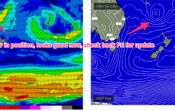
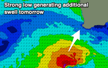
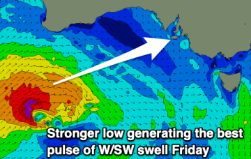
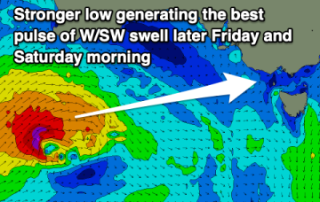
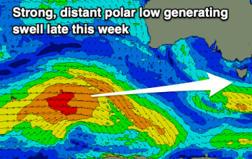
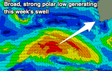
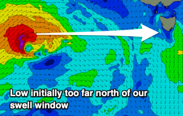
A tight low firing up under Western Australia today will produce a better pulse of westerly swell over the coming days and while winds are far from perfect there should be a few workable options.
Nothing major in size but persistent small swells out of the west with workable winds.
Options will be limited with the coming swell this week as a high pressure ridge moving in from the west slows the local improvement in winds.
Short term and the western flank of the high creates a NE fetch off the South Coast and extending across Bass Strait through tomorrow to Thursday.
A broad but weak tradewind fetch pushes south from the Coral Sea, extending out towards New Caledonia, and looping around a long trough extending from roughly Lord Howe up into the tropics.
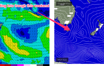
We’re right up to our neck in a troughy La Nina pattern, which continues on through this week. High pressure is sitting just to the East of Tasmania, with the dissipating remains of the weekend’s trough of low pressure linked to a coastal trough extending up into the sub-tropics