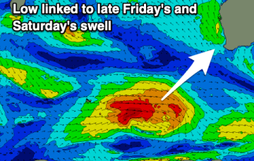
New swells from Sunday, tiny before hand
Wednesday, 26 January 2022
New swells from Sunday, tiny before hand
Wednesday, 26 January 2022
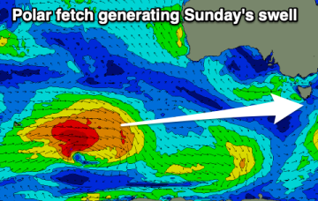
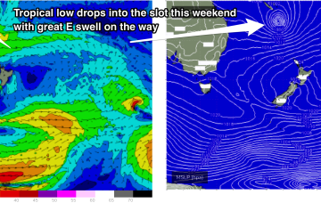
Give the coming days a miss and aim for a surf from Sunday onwards.
Give the coming days a miss and aim for a surf from Sunday onwards.
Building swell energy with generally favourable and workable winds each morning over the coming days.
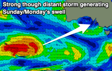
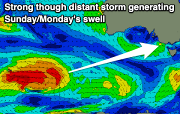
Nothing to recommend over the coming days until Sunday and more so Monday.
There's a window of cleaner conditions and fun swell for early next week before we settle back into an unfavourable pattern.
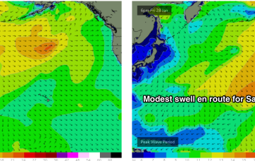
A tiny week of waves, bumping up a touch into the weekend for the keen.
The pattern change we spoke about on Fri then kicks right in, with blocking high pressure in the North Pacific shunting storms northwards towards the Aleutian Islands.
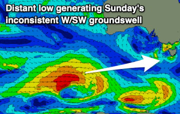
Fairly favourable winds with easing surf from today, increasing again from late week.
New high pressure slips into the Tasman Thursday and immediately has the pressure gradient on the western flank tightened by an interior trough system. That sees a fast developing N to NE fetch off the Far South Coast and Gippsland build NE windswell off the NE Coast of Tasmania during Thurs.
The tradewind flow through the Central/Southern Coral Sea gets a boost later this week and into the weekend as a tropical low forms between Vanuatu and New Caledonia.
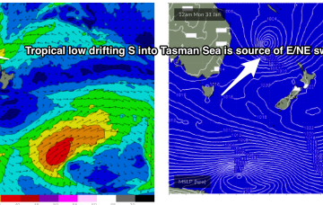
A trough of low pressure has drifted south-westwards from the South Pacific into the area west of the North Island and looks a touch healthier than it did during Friday.