Easing surf into the weekend with more action next week
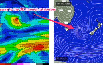
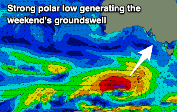
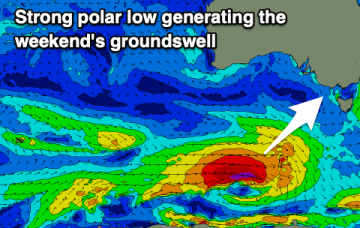
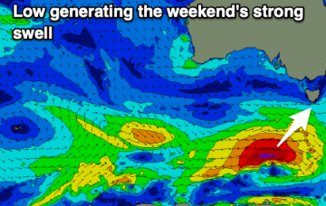
The southern part of the fetch is well aimed for Tasmania’s Easy Coast, even though the strongest winds are to the north.
This fetch is producing a fast rising S swell through today in Southern NSW, with the bulk of the swell generation for our f/cast region occurring once the fetch moves out of swell shadow of the Hunter curve.
Small, weak swells over the coming days with favourable morning winds. New swell activity developing next Thursday onwards.
There's plenty of swell for the South Coast this period and winds will slowly improve over the coming days.
The squeeze between a 1001 hPa low off the South Coast and 1030 hPa high moving through the Eastern Bight is producing a line of gales off the NSW South Coast, extending northwards up to the Hunter and southwards into the Tasman Sea.
Winds are tricky over the coming days but workable for most regions. The beaches will get better and better from Sunday but more so early next week.
Lots of swell activity with favourable winds for the most part besides a couple of dicey days.
Another low forms in the trough line off the NSW Central Coast Tues, rapidly re-invigorating a robust S to S/SE fetch off the South to Central Coast before slowly drifting off to the SE later this week. This fetch is enhanced by a pressure gradient squeeze with another strong high currently moving East in the Bight.
The coming period is looking very slow so make the most of a fun new swell tomorrow.
Meanwhile, out in the South Pacific a sub-tropical low is deepening well E of the North Island with a well aimed fetch expected to be aimed at the sub-tropics generating a long range E’ly groundswell for the weekend.