Strong swell incoming
Friday, 18 March 2022
Strong swell incoming
Friday, 18 March 2022
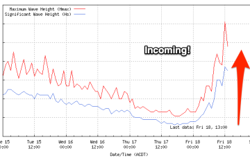
We've been waiting all day but the buoy is looking good and there are signs of new swell starting to show.
We've been waiting all day but the buoy is looking good and there are signs of new swell starting to show.
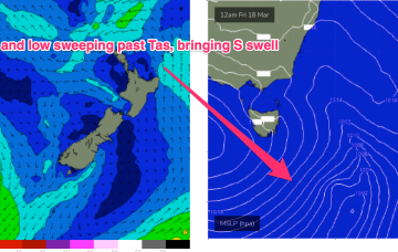
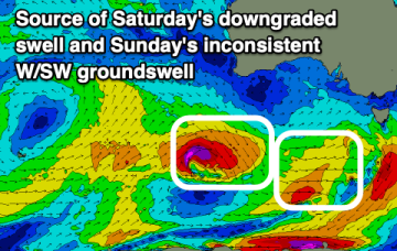
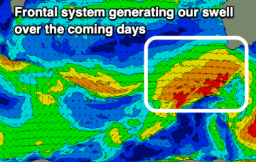
That front then forms a low, which becomes slow moving as it tracks NE towards the North Island. Swell is incoming from the front and the low, generating swell from the southern quadrant.
That front then forms a low, which becomes slow moving as it tracks NE towards the North Island. Swell is incoming from the front and the low, generating swell from the southern quadrant over the weekend and into next week.
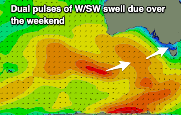
Winds will improve through tomorrow (for the beaches) along with a new swell, easing Sunday with early light morning winds. Next week looks fun on the beaches up until Wednesday.
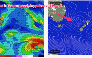
In addition a NE fetch is located off the NSW South Coast, generating E/NE to NE swell.
A broad, angular area of low pressure in the Northern Coral Sea, extending southwards is maintaining good windspeeds in the tradewind fetch at the moment and that is leading to surf punching slightly above it’s weight.
Both these fetches are going to supply fun sized mid period swells going into the weekend with a front and low expected in the Tasman Sea over the weekend.
Nothing too major this period and with dicey winds for the most part. A slower period than we've had the past few weeks.
A tricky forecast with improving and varying winds through most mornings along with some good swell.
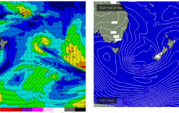
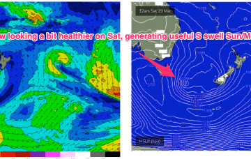
Bit of an upgrade now for Sunday as a parent low tracks into the Tasman Friday with a much healthier fetch fetch of S to SSW winds extending through the lower Tasman.