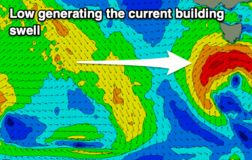
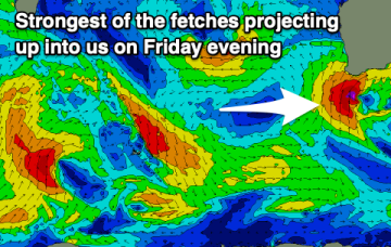
Mostly flat- just a tiny wave at super exposed locations
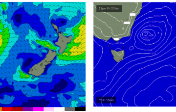
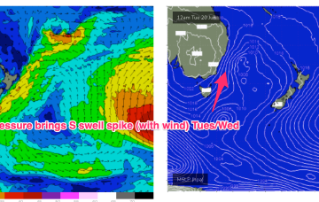
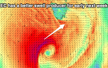
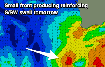
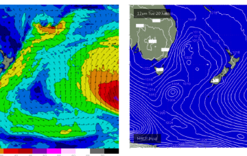
None of these features generate swell for CQ, so we're looking at a typical winter flat spell.
The end of the week now looks good for a chunky NE windswell as twin high pressures develop a fetch of NE winds off the South Coast which intensify in response to approaching frontal systems. There’ll also be some E-E/NE swell from a fetch near the North Island.
The outlook is very slow after Wednesday so make the most of the current swell episode.
The wind and poor conditions kick back in this week with a couple of windows to the north.
High pressure over the continent its still ridging along it’s Southern flank with a westerly belt creating flat, groomed conditions. A deep, compact low is well SW of Tasmania, weakening as it enters the lower Tasman. A decaying front linked to the low spawns a broad area of low pressure in the Tasman tomorrow and then lingers in the Tasman for most of the week.
Great conditions with a fun southerly swell for tomorrow, fading into Wednesday.
High pressure over the continent its still ridging along it’s Southern flank with a westerly belt creating flat, groomed conditions. A deep, compact low is well SW of Tasmania, weakening as it enters the lower Tasman. A decaying front linked to the low spawns a broad area of low pressure in the Tasman tomorrow and then lingers in the Tasman for most of the week.
We've got one final swell pulse on the build that will be worth making the most of ahead of a brief, slow period.
Set your expectations low for the weekend thanks to the wind and westerly swell. Early next week is a touch more promising.
A better outlook for the South West this weekend compared to recent days, with onshore winds kicking back in next week.