Slow, clean week before the storms and swell roll back in
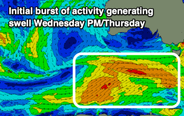
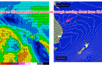
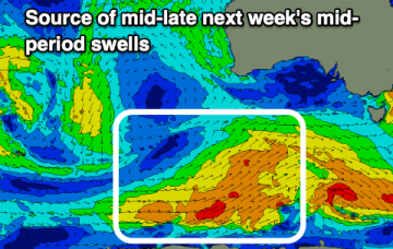
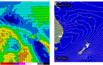
Smaller surf this week but with cleaner conditions. The fronts and swell will kick back in next week.
Tomorrow looks great down South ahead of a trickier period of weaker swells and varying winds.
High pressure sitting up at sub-tropical latitudes is allowing a very active series of fronts to penetrate NE into the Tasman Sea. A very slow moving monster high tracking into WA longitudes is anchoring a sustained SW flow as the fronts ride up it’s extended flank from the Southern Ocean into the Tasman. We’ll see multiple S swell pulses from this set-up, becoming stronger over the weekend.
The coming period will consist of weaker swell energy but with workable winds for protected spots.
Keep your expectations in check for the weekend and focus on the action from later next week.
We’ll see some small background surf over the weekend and into next week from a trough and low in the South Pacific but only for exposed locations and only small, inconsistent 1-2ft surf tops.
High pressure over the continent and off the QLD Coast is still supplying ridging which is now being strengthened by the next series of troughs and fronts. Off Tasmania a small low pressure cell is slowly moving away with easing onshore winds and a chunky NE swell still building.
Long lined, inconsistent E-E/SE swell will continue next week, from a source near Tonga then a closer low forming on a persistent trough line closer to the North Island. This closer system is right on the edge of the swell window.
We can expect a slow improvement in conditions again this weekend again but with a weakish, easing S/SW swell.
We'll see a building NW windswell tomorrow ahead of a large W'ly groundswell on Sunday in the gulf, more sheltered down South.