Indonesia/Maldives forecast Apr 17
Thursday, 17 April 2025
Indonesia/Maldives forecast Apr 17
Thursday, 17 April 2025
Make the most of then coming swells for Saturday and next week.
Make the most of then coming swells for Saturday and next week.
The coming outlook is a bit slower with mostly clean conditions but smaller swells.
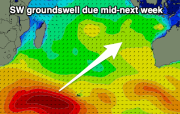
The coming day's won't be as favourable for exposed spots with a fun weekend across the South West magnets. Next week is more active.
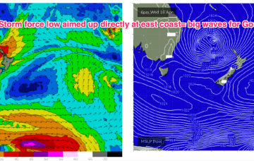
This storm force low has a broad fetch aimed directly at the East Coast, but will be positioned too far south to generate much in the way of swell for CQ.
After a binary interaction between the two systems, the merged low transitions into a storm force sub-tropical low which tracks SW into the Northern Tasman. This storm force low has a broad fetch aimed directly at the East Coast down to Tasmania, generating a large E’ly quadrant swell for Good Friday and the Easter weekend with uncommonly large swell periods for swells from that direction.
After a binary interaction between the two systems, the merged low transitions into a storm force sub-tropical low which tracks SW into the Northern Tasman. This storm force low has a broad fetch aimed directly at the East Coast, generating a large E’ly quadrant swell for Good Friday and the Easter weekend with uncommonly large swell periods for swells from that direction.
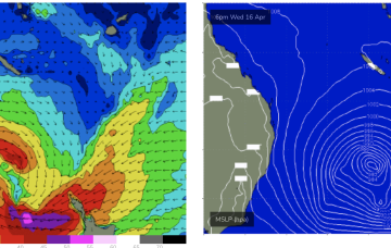
South Australian forecast by Craig Brokensha (issued Wednesday April 16th)
Best Days: Both coasts Friday, South Coast Saturday morning, South Coast Wednesday morning, South Coast Thursday morning
Features of the Forecast (tl;dr)
A tropical depression between Vanuatu and New Caledonia has formed a tropical cyclone (TC Tam) and is racing south-eastwards at 23kts, where it is expected to merge with another tropical low SW of New Caledonia. After a binary interaction between the two systems, the merged low transitions into a storm force sub-tropical low which tracks SW into the Northern Tasman.
The coming period looks best for the beaches both wind and swell wise.
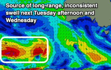
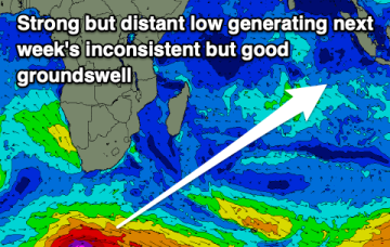
New swell due for the weekend, with a good, long-range swell for next week.