Slim pickings until next week
Wednesday, 29 December 2021

Slim pickings until next week
Wednesday, 29 December 2021
The coming days aren't especially great with more options opening up next week.
The coming days aren't especially great with more options opening up next week.
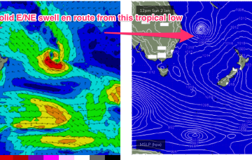
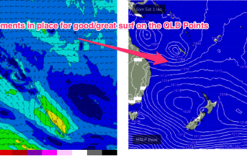
Surf prospects from this low are now upgraded to excellent with major weather models expecting the system to track parallel to the East Coast on a Southerly path, possibly reforming as a significant extra-tropical storm in the lower Tasman Sea next week.
The outlook for the coming period isn't especially great but there are a couple of small windows worth capitalising on.
Make the most of the cleaner conditions and fun waves on the exposed beaches over the coming days before things turn to the proverbial next week.
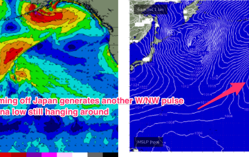
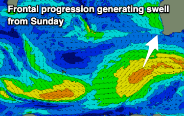
Swell eases Wed before two more pulses of NW swell, generated by fronts pushing off the Kuril Islands, before being shunted up towards the Aleutian Islands.
Nothing special with with early light winds, cleanest and best Thursday morning.
The high pressure surge sees SE winds developing into the 20-25 knot range north of Fraser into the Capricorn channel during Wed, strengthening during the day.
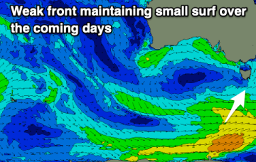
A few small/tiny days follow as weak pressure gradients become established as high pressure drifts across the State.
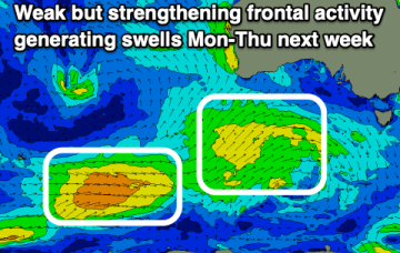
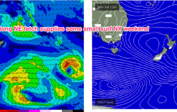
The main issue this week will be the lack of decent sized swell. A bit more energy is due Sunday and Monday but with less than ideal winds.
In the tropics the Monsoon trough is now active, with good odds of cylogenesis occurring before the New Year and plenty of surf ahead.