Nothing great but a few windows
Friday, 31 December 2021

Nothing great but a few windows
Friday, 31 December 2021
The main issue is the incoming swells but Sunday is now looking a bit better wind wise.
The main issue is the incoming swells but Sunday is now looking a bit better wind wise.
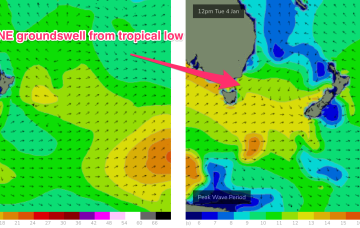
While there is still a bit of model variance the broad scale pattern is clear enough to make a high confidence call on Mon seeing a significant pulse of E/NE groundswell across the region.
Make the most of the small waves down South today as the coming forecast period isn't too special. There'll be a couple of small Mid Coast days.
Get stuck in today as the coming outlook is generally poor into the New Year.
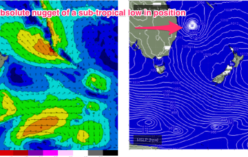
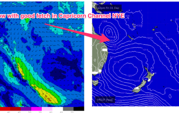
A hybrid tropical low is now located E/SE of Cairns and moving SE, energising a long, broad fetch of SE winds as it squeezes onto a supporting high pressure system in the Tasman Sea
Following that a severe winter storm forming north of the Aleutian arc this weekend and swinging from the Alaska Peninsula with storm force winds is aimed mostly at West Coast USA targets.
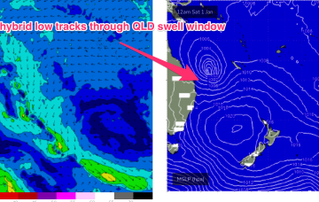
Friday looks to be the best day from Yeppoon southwards. The low will be intensifying as it drifts level with the Capricorn Coast
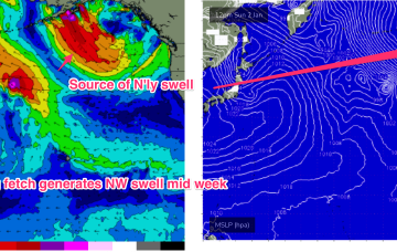
Tasmania won’t miss out with NE groundswell from the tropical system showing up Tues.
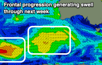
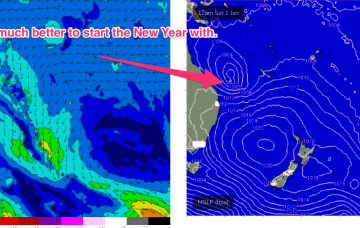
Surf prospects from this low are now confirmed as excellent with major weather models expecting the system to track parallel to the East Coast, spraying the region with swell as it does so and, possibly reforming as a significant extra-tropical storm in the lower Tasman Sea next week.
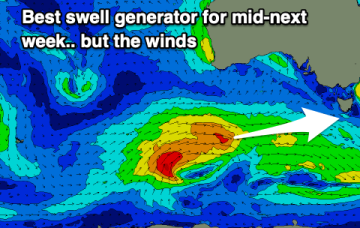
We'll see clean fun waves tomorrow morning, clean again Friday and Saturday mornings but tiny. There's a bit of swell next wind but the winds are poor.