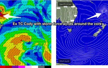
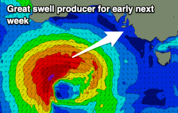
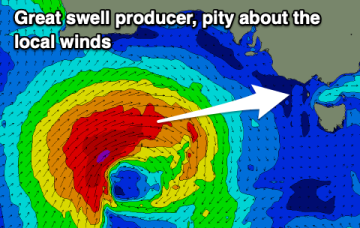
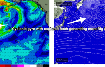
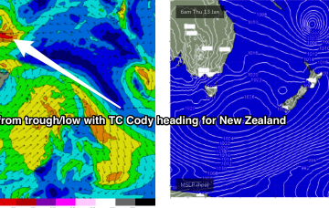
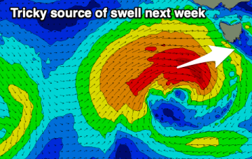
Long period pulsey swell from Ex TC Cody incoming early next week
Friday, 14 January 2022

Long period pulsey swell from Ex TC Cody incoming early next week
Friday, 14 January 2022
The slowed movement and enlargement of the wind field as it approaches the North Island are on track to deliver more powerful long period E-E/NE swell, not ideally aimed for Tasmania but with enough strength to deliver some 3-4ft sets through Mon and Tues.