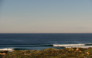
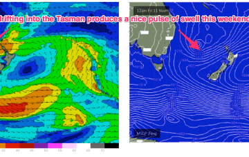
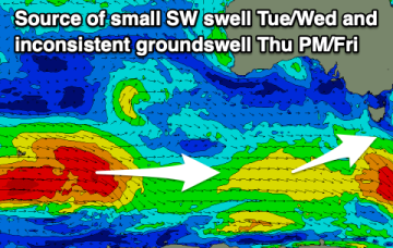
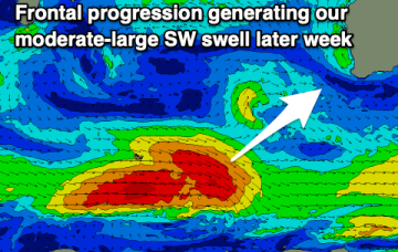
Good swell with onshore winds tomorrow
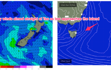
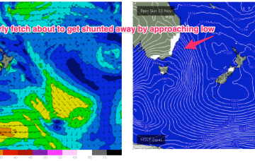
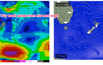
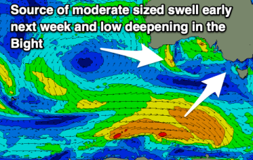
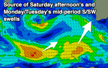
A tricky period with a good swell spoilt by onshore winds tomorrow, improving slowly from Friday but with smaller, weaker S/SW swells.
A more local fetch of NE winds is now developing off the South Coast of NSW and into Bass Strait with a corresponding rise in NE windswell expected for NETas.
We’re in the middle of the blocking pattern which is coming in a little weaker than modelled. High pressure (1025hPa) sits in the Central Tasman directing a fairly insipid SE flow through most of the Central/Northern Tasman and extending into the Coral Sea. A long trough through the Coral Sea and South Pacific with embedded low pressure centres is not tightening the pressure gradient to the extent modelled. As a result surf is coming in at the low end of f/cast expectations, and this soft trend is expected to continue.
A long trough through the Coral Sea and South Pacific with embedded low pressure centres is not tightening the pressure gradient to the extent modelled. As a result surf is coming in at the low end of f/cast expectations, and this soft trend is expected to continue.
The surf will build through tomorrow as winds shift and change, onshore Friday but only light and workable. The weekend is a little mixed.
Get stuck in today and tomorrow before conditions deteriorate Friday, improving temporarily Sunday. Next week looks windy with a couple of swell sources.
A long trough line extending from the Solomon Islands to the North Island spins off some small low pressure areas this week. Although not quite as spectacular as model runs suggested last week we’re still in for some fun NE swell this week with a juicier pulse expected late this weekend and into early next week.
An active Southern Ocean storm track will deliver plenty of swell for us this period and beyond.
We’re looking at a fairly static, summer-style blocking pattern this week with semi-stationary high pressure in the Tasman, and a ridge up along the Eastern seaboard with SE winds in the North, E/NE to NE winds from the Mid North Coast down to Southern NSW. A long trough line extending from the Solomon Islands to the North Island spins off some small low pressure areas this week. Although not quite as spectacular as model runs suggested last week we’re still in for some fun E swell this week with a juicier pulse expected late this weekend.
Easing surf tomorrow with clean conditions through the morning ahead of developing onshore winds and a moderate-large SW swell later week. Conditions will improve slowly on the weekend.