Winds continue to create tricky conditions
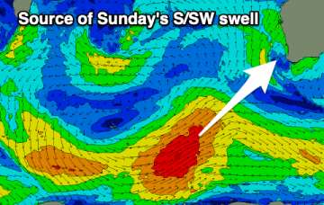
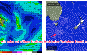
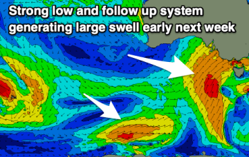
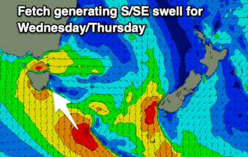
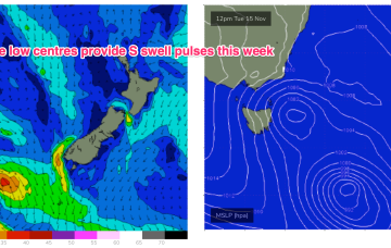
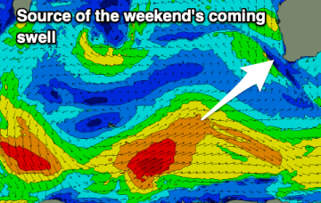
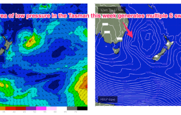
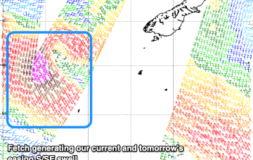
There's a ton of swell inbound but conditions will be tricky to work around due to mostly unfavourable local winds.
We've got strong winds and building surf over the coming days with improving quality across Perth and Mandurah through the weekend, more so Monday in the South West.
The low east of Tasmania moves NE and joins other areas of troughy low pressure to form a large low pressure gyre which occupies most of the Tasman Sea through the latter part of this week. Surf size will be limited by the relatively weak supporting high pressure cell which is currently tracking through the Bight. We’re still looking at plenty of moderate size surf from the S quadrant to end the week and carry through into the start of the weekend.
We've got some fun swells and cleaner conditions over the coming days ahead of another strong cold-outbreak and return to winter.
Conditions will improve into the end of the week with some fun new swell, easing through the weekend. Next week looks cold, windy and sizey as a strong cold-outbreak pushes up and over us.
Chunky waves over the coming days with tricky and generally poor winds.
A warm front has bought a W’ly change to temperate NSW, extending southwards to Tasmania. Through the early part of this week the low slips SE of Tas and a complex, troughy pattern with multiple low centres sits in the Tasman. This complex low pressure area eventually gets squeezed by an oncoming high generating fresh S’lies and which overlap with deeper S’ly fetches to create a series of S swells this week.
A couple of clean mornings but small surf, onshore through the end of the week before improving slowly on the weekend.
Through the early part of this week the low slips SE of Tas and a complex, troughy pattern with multiple low centres sits in the Tasman. This complex low pressure area eventually gets squeezed by an oncoming high generating fresh S’lies and which overlap with deeper S’ly fetches to create a series of S swells later this week.