Indonesia/Maldives forecast October 17th
Tuesday, 17 October 2023
A strong front and embedded trough of low pressure are currently located just off the Gippsland Coast, expected to move NE into the Tasman and driving a strong/ near gale force S’ly flow up the NSW Coast today, reaching the QLD in the wee hours of Tuesday. We may see a small increase in SE swell as the S-SE surge reaches CQ coastline on later Tues. Nothing major, but we may see surf bump up a touch into the 1-1.5ft range Tues a’noon, holding at that size or 1-2ft Wed.
A strong front and embedded trough of low pressure are currently located just off the Gippsland Coast, expected too move NE into the Tasman and driving a strong/ near gale force S’ly flow up the Tasmanian Coast today. There’ll be an initial burst of S swell associated with the proximate fetch before the low moves NE out of the Tasmanian swell window.
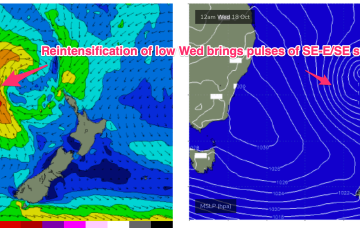
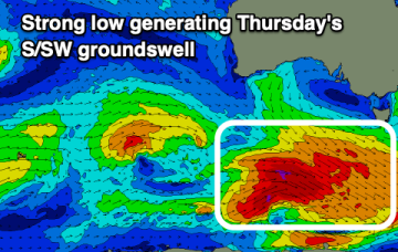
A strong front and embedded trough of low pressure are currently located just off the Gippsland Coast, expected too move NE into the Tasman and driving a strong/ near gale force S’ly flow up the NSW Coast today, reaching the QLD in the wee hours of Tuesday. There’ll be an initial burst of S swell associated with the proximate fetch, with some better quality SE-E/SE swell from a secondary intensification of the low as it becomes slow moving near New Zealand.
The current swell will ease tomorrow while some new energy is due mid-week, onshore at the peak.
A strong front and embedded trough of low pressure are currently located just off the Gippsland Coast, expected too move NE into the Tasman and driving a strong/ near gale force S’ly flow up the NSW Coast today, reaching the QLD in the wee hours of Tuesday. There’ll be an initial burst of S swell associated with the proximate fetch, with some better quality SE-E/SE swell from a secondary intensification of the low as it becomes slow moving near New Zealand.
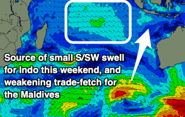
There's no swell of size or significance this period.
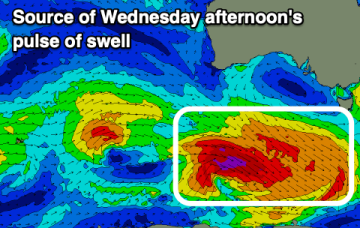
We've got improving conditions and a fun swell due this week, with it back on the cards after being downgraded late last week.
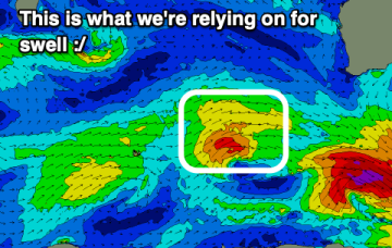
Tomorrow will be a little average but improving, fun from Wednesday with favourable winds and a good pulse of swell in the mix.
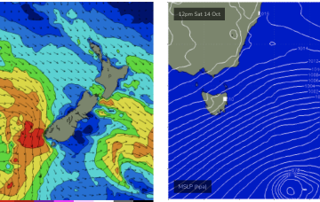
Unfortunately for NETas the low quickly moves NE with the fetch located too far north to generate meaningful swells for the east coast.