Great week of surf ahead

Western Australia Surf Forecast by Craig Brokensha (issued Monday 22nd April)
Best Days: Every day this week across all regions, though biggest north of Margs Tuesday/Wednesday and Thursday
Recap
Friday's large powerful mix of swells eased back through the weekend while slowly improving. It was protected spots only Saturday in the South West, pumping Sunday with clean easing 8ft surf. Mandurah and Perth were solid Saturday, pumping and clean, still excellent Sunday with a bit of size.
Today the surf is smaller again but still pumping around Margs, smaller and back to 1-2ft in Mandurah and 1-1.5ft in Perth.
Today’s Forecaster Notes are brought to you by Rip Curl
This week and weekend (Apr 23 - 28)
This week will revolve around tomorrow and Wednesday's large, long-period though slightly inconsistent W/SW groundswell event.
This swell was generated through last week and into the weekend by a broad and vigorous slow moving storm that developed south-east of South Africa, with winds reaching severe-gale strength.
The low moved slowly east while weakening gradually through the weekend and we should see the long-period groundswell arriving through tomorrow morning, building strongly into the afternoon and reaching 10ft+ across the South West, 3ft in Mandurah and 2-3ft in Perth.
Winds in the morning when the swell starts building will be great with straight offshores, giving into afternoon sea breezes.
Wednesday morning looks the pick as the groundswell eases from 8-10ft or so in the South West, 3ft in Mandurah and 2-3ft in Perth. Winds should be offshore out of the E/SE tending S'ly through the afternoon.
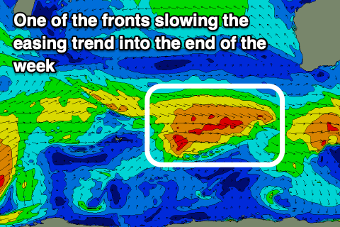 The easing trend through the end of the week will be slowed by weak but persistent frontal systems moving through our south-western swell window during this week.
Winds will be great as well as the fronts stay south enough for us to see morning offshores.
The first swell for Thursday should maintain 6ft+ waves across the South West, 2ft+ in Mandurah and 2ft on the sets in Perth, with Friday persisting at 5-6ft, 2ft and 1-1.5ft respectively.
Winds on Thursday will be offshore out of the E/SE and only S/SE into the afternoon, with E/NE winds Friday morning, variable from the N'th into the afternoon.
Into the weekend the surf will start to go off the boil with easing size and winds from the NE to NW.
Longer term the outlook offers some interesting possibilities early next week as a mid-latitude front possibly interacts with a tropical cyclone drifting down from the north, but more on this Wednesday.