Conditions remain best north of the Margaret River region

Western Australia Surf Forecast by Craig Brokensha (issued Wednesday 5th July)
Best Days: Perth and Mandurah Thursday and Saturday mornings, protected spots in the South West Saturday morning, northerly friendly breaks Sunday
Recap
Poor conditions across the Margaret River region yesterday with a building onshore swell, while Perth and Mandurah offered fun waves with 2ft sets.
Today an approaching change brought poor conditions to all coasts and now in its wake an increase in stormy swell.
This week and weekend (Jul 6 – 9)
Currently a strong frontal system is pushing across us, with it forming earlier this week in the Heard Island region.
While an increase in stormy windswell is being seen today, some stronger mid-period SW swell is due to fill in and peak tomorrow.
 The South West should see 6-8ft surf, easing through the day with 3ft waves around Mandurah and Perth.
Conditions are still looking poor across the South West with a fresh and gusty SW breeze tomorrow morning, tending more W/SW through the day.
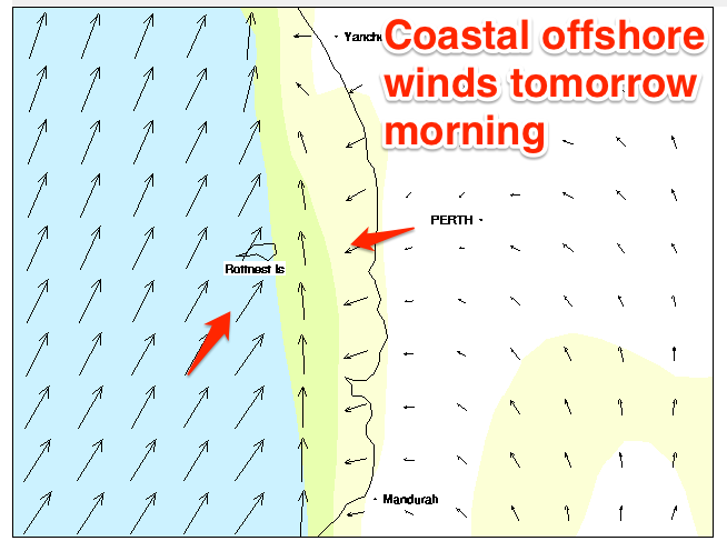
Perth and Mandurah are still on track to see lighter E'ly breezes, but with onshore winds out to sea (shown right), conditions will be quite mixed and not perfect (still more than worth a surf).
Onshore winds are then due to kick in across all locations on Friday as a weak trough moves in and across us along with easing levels of mid-period SW swell.
Into Saturday our good new long-period S/SW groundswell is still on track. A pre-frontal fetch of W/NW gales set in motion a small active sea state for an additional fetch of gale to severe-gale W/SW fetch to move over this morning.
The polar low is now moving on east while weakening slightly, with the groundswell due to arrive late Friday and peak Saturday morning across the state.
Margs should see good 6ft to occasionally 8ft sets at exposed breaks, easing through the day with 2ft+ waves around Perth and Mandurah.
Conditions are looking good across Perth and Mandurah with a light morning E/NE breeze, while it's still a little up in the air regarding whether Margs will see a light morning S/SE'ly. You'll have to check back Friday for an update on this.
Sunday will see NE winds across all locations though but half the amount of swell.
Into early next week smaller S/SW swells are due across Margaret River, generated by weak polar fronts skirting our swell window and it looks like winds will swing NW with stronger approaching frontal systems from the south-west.
These fronts are likely to generate some larger swell mid-late week and for the following weekend but with onshore winds. More on this Friday.