Fun swell tomorrow with deteriorating winds, good for exposed spots from Sunday

Western Australia Surf Forecast by Craig Brokensha (issued Wednesday 21st October)
Best Days: Early Thursday in the South West, Sunday onwards exposed breaks in the South West
Recap
Solid clean and easing 5-6ft waves across the South West yesterday morning with 2ft sets around Mandurah and Perth before sea breezes kicked in.
Today conditions are clean again but the swell smaller with a reinforcing pulse keeping 3-5ft sets hitting exposed breaks, with 1-1.5ft waves around Perth.
This week and weekend (Oct 22 - 25)
This afternoon a stronger kick in SW groundswell is due across the South West (not arriving till after dark around Perth), easing through tomorrow.
This groundswell should offer good 5-6ft sets across the South West with 1ft to occasionally 2ft waves across Perth, easing into the afternoon.
Come Friday the swell should steady as a reinforcing SW swell fills in, generated by a fetch of pre-frontal W/NW gales behind the main progression responsible for later today's swell.
This should keep 3-5ft waves hitting exposed breaks around Margs but only come in at 1-1.5ft around Perth.
Winds aren't looking as favourable for tomorrow as a deepening surface trough over the state drifts east, bringing SE tending S/SE winds to the South West, with onshore W/SW winds around Perth (possibly variable on first light).
Friday will then see S/SW onshores across Margs, with SW winds around Perth.
Some small weak S/SW windswell will develop from these onshore winds, but not above the size of the reinforcing SW groundswell Friday.
Into Saturday the swell will ease back a touch further, steadying Sunday to an inconsistent 3-4ft+ across swell magnets in the South West and 1ft around Perth.
Winds will improve a touch from the S/SE Saturday, with Sunday being the pick under E/SE offshores before S/SW sea breezes kick in.
Next week onwards (Oct 26 onwards)
There's nothing too major on the cards for next week, with small background levels of SW groundswell with favourable offshore E/NE winds each morning up until Thursday.
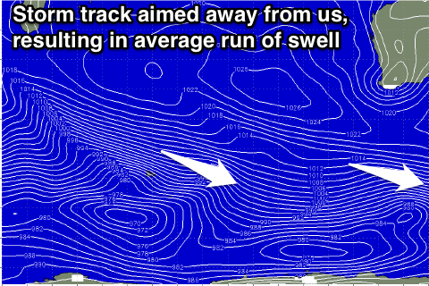
The storm track will remain focussed away from us into the middle of end of next week, with a touch more size due into Thursday/Friday. Winds may go funky though as a weak low develops off the coast, directing weak NW winds into us, but we'll review this Friday.
Comments
Some bombs at Margs this morning.