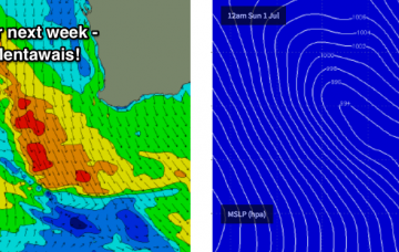
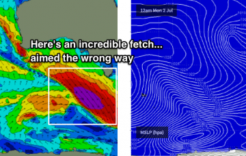
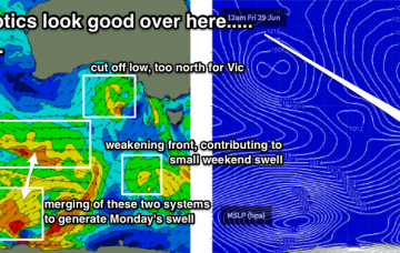
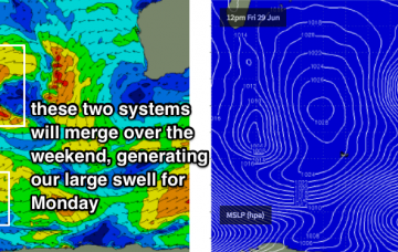
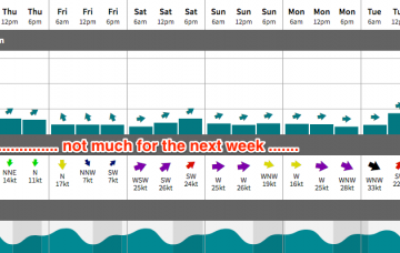
Extended period of windy conditions ahead; looking large from later next week onwards
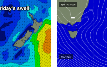
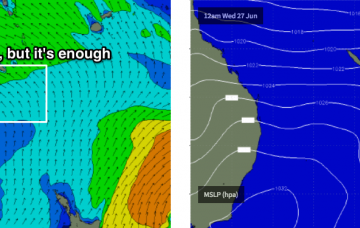
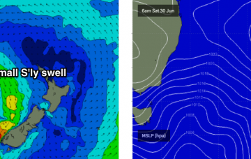
No change to the weekend surf outlook: I’m still not particularly enthused.
Today's swell has reached a peak and will trend down through Friday.
Friday still has a nice north-east swell on the way, and with a poor outlook beyond that you’ll want to make the most of it.
Unfortunately our bleak outlook remains as were a few days ago.
The trades across the Southern Coral Sea reached a maximum today so we’re looking at a peak in size on Thursday, before wave heights slowly ease into Friday.
With today’s SE swell punching above its weight, it’s a fair consideration to add a little more size on Thursday’s projection.
The most promising part of this weather progression is probably the interaction between a polar low and a pre-frontal W/NW flow to its north, positioned S/SW of WA on Thurs/Fri.
The synoptic chart looks good in single snapshots, but unfortunately for us the broader picture isn’t in sync and this will maintain low wave heights across the Surf Coast.
Friday is probably the pick of the period as we'll have the best conditions, though size will be only borderline surfable across metro beaches.
The storm track just isn’t favourable for the South Arm at the moment.