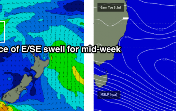
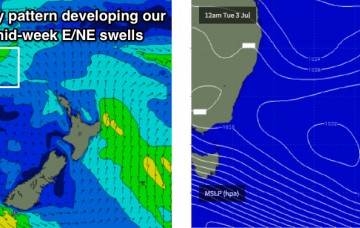
Nice round of SE swell for the points
Monday, 2 July 2018
Nice round of SE swell for the points
Monday, 2 July 2018
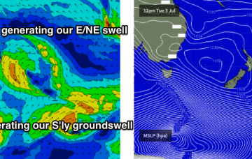
There’s been some interesting upgrades in the model guidance for this Far North Coast low over the last few days.
There’s been some interesting upgrades in the model guidance for this Far North Coast low over the last few days.
We've got a tricky week ahead with only flukey swell sources to work around.
It’s a great synoptic pattern for swell on the Mid Coast though we’ve obviously got a lot of onshore wind to deal with.
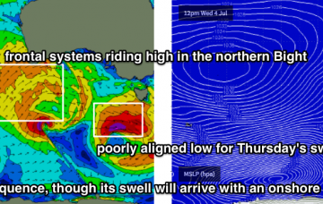
We’ve got a classic winter frontal progression bearing down on the southern states.
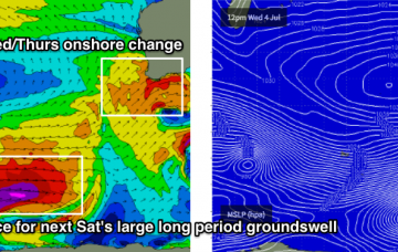
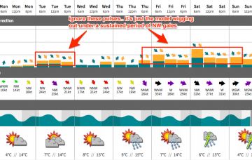
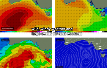
Look, we can delve into the nitty gritty of the outlook but the long and short is that we’ve got an extended period of craptacular conditions on the way, thanks to a sustained frontal progression across the southern half of the state. However, next weekend is looking potentially fantastic at this stage.
No doubt you’ve already read the South Arm Forecaster Notes, but if you’ve come here for solace you’re in for a shock.
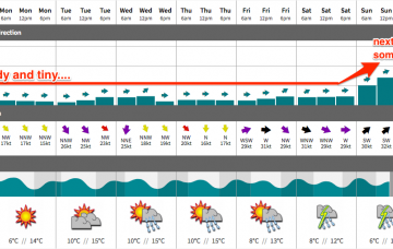
No change to Thursday’s outlook. The Southern Ocean remains very active, but completely aligned out of our swell window.
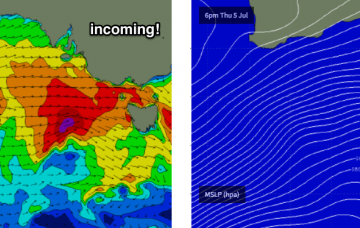
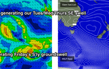
There’s not a great deal of size or strength expected for the weekend, though Saturday will offer the best surf of the next few days
This will kick up a fresh south swell for Sunday, though it’ll only get into a handful of exposed south swell magnets as it glances the coast.
Not an inspiring weekend ahead.