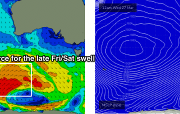
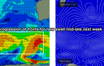
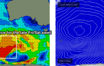
Plenty of surf on tap, next week looks fun with light winds
Wednesday, 27 March 2019

Plenty of surf on tap, next week looks fun with light winds
Wednesday, 27 March 2019
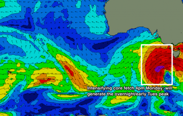
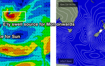
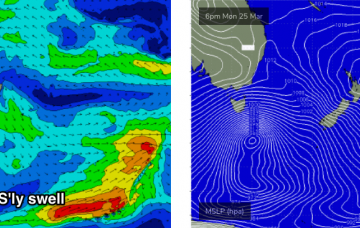
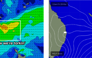
Stacks of surf ahead, but with initially dicey conditions for both coasts. More in the Forecaster Notes.