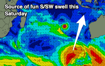
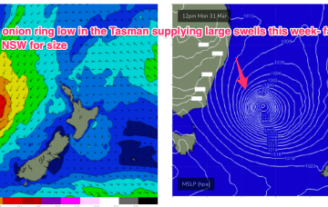
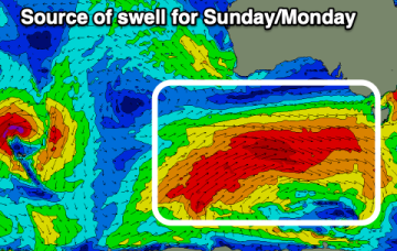
Fun swell Friday, with a larger SW groundswell for Sunday/Monday
The Mid Coast looks fun into the end of the week with larger surf for the South Coast from later Sunday.
We’ll see the low meander towards the South Island for the remainder of the week, with large swells on the ease across Southern/Central NSW, much less size into the sub-tropics.
The end of the week isn't great, with improving, building swells due through the weekend thanks to a strong node of the Long Wave Trough.
Fun swell this weekend, then slow again.
A strong swell tomorrow will be spoilt by onshore winds, better Wednesday with some decent activity due into next week.
These winds will coalesce later today into a more organised fetch of S-SE gales as the system slowly tracks southwards then S/SE. As a result we’ll see elevated wave heights from the E/SE-S/SE right into mid-week, augmented by some long range S/SE groundswell from another ice shelf fetch in the Ross Sea region adjacent to Antarctica.
The coming period will become better from Wednesday but with plenty of wind.
We have a powerful swell generating pattern in place with a deep low (993hPa) in the Tasman, supported by a large high (1033hPa) well to the south of the Bight.
The coming week isn't great but the South Coast should offer a window Wednesday and then the Mid Coast later week.
We have a powerful swell generating pattern in place with a deep low (993hPa) in the Tasman, supported by a large high (1033hPa) well to the south of the Bight.