Surf becoming large over the weekend as low forms off South Coast
Wednesday, 26 March 2025
Surf becoming large over the weekend as low forms off South Coast
Wednesday, 26 March 2025
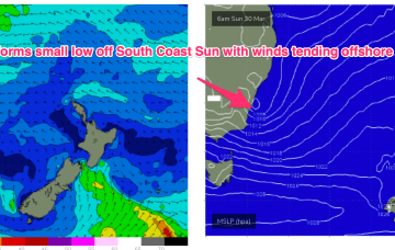
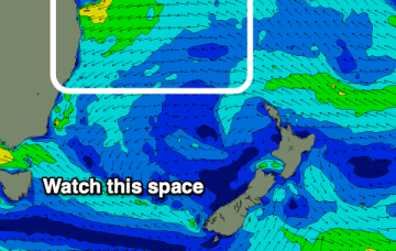
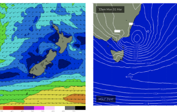
We’ll see surf from this NE-E/NE infeed propagate from the sub-tropics down to temperate regions over the weekend, eventually generating swells for NETas as a surface low forms from the trough off the south coast of NSW and moves towards Bass Strait.