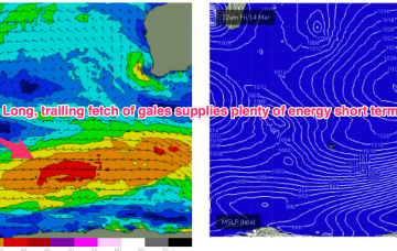
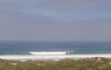
Nice round of surf on the way
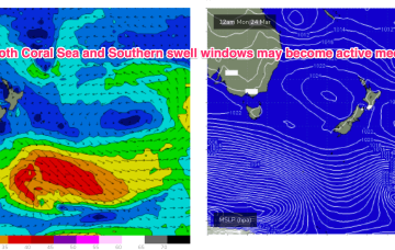
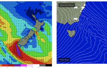
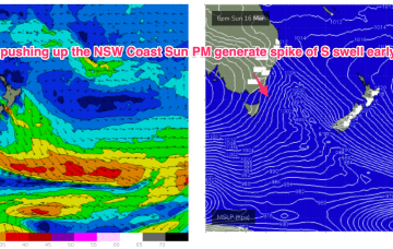
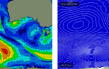
A new long period groundswell is then expected to rebuild into Wednesday, sourced from an intense polar low skirting the ice shelf on Sunday.
We’ve got a solid run of autumn swell lining up for the state next week, thanks to a powerful conveyor belt of Southern Ocean fronts and lows generating overlapping groundswells that’ll arrive from Sunday thru’ Friday.
As stated on Wed, the Indian Ocean is quite active with a long fetch of W’ly gales currently SW of the state and moving E. That will supply reinforcing pulses of SW swell later in the weekend into Mon .
A powerful conveyor belt of Southern Ocean fronts and lows will generate overlapping groundswells that’ll arrive from Sunday thru’ Friday.
Weak high pressure is in the Tasman with a modest tradewind fetch in the Coral Sea with another weak high moving into the Tasman in it’s wake. Trades perk up today into tomorrow suggesting a small bump in size over the weekend into Mon before easing early next week.
SW gales push through Bass Strait and adjacent to the Tasmanian East Coast Sun night and into Mon.
SW gales push through Bass Strait and off the Far South Coast Sun night and into Mon with the bulk of the frontal winds now likely to reach Coffs around 7am, Byron by lunch and the border around school pickup
SW gales push through Bass Strait and off the Far South Coast Sun night and into Mon with the bulk of the frontal winds likely to extend up to Sydney in the hours before dawn.
We’ve got a weekend of two halves on the way.
Into next week and a long fetch of gale force winds in the screaming 50’s later this week supplies plenty of energy into next week, although nothing major. The position of the long wave trough favours Victoria as those winds form low pressure and aim up more directly at SE Aus.