Lotsa swell, lotsa wind too
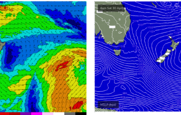
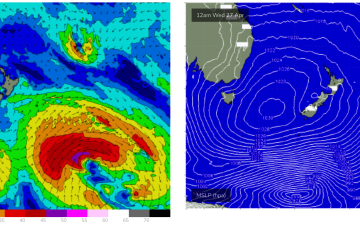
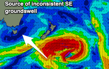
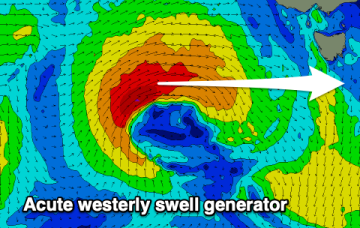
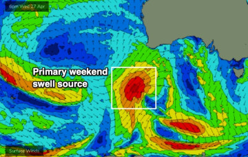
We’ve got a week of solid, occasionally windy conditions ahead as more fronts push on to the coast and the Southern Ocean conveyer belt delivers a series of powerful back-to-back groundswells.
Those Tradewinds will be too far north for Tas at least in the short term but increasing NE winds off the NSW South Coast will see surf peak around 2-3ft+ through Thurs.
A deepening, multi-centred mid-latitude low pressure system is currently developing south of the Bight, and is expected to kick off san impressive conveyor belt of Southern Ocean fronts and lows throughout the medium term period.
These expanded and increased Tradewinds are set to directly benefit the CQ coast over the next few days and into next week.
A large 1029 hPa high pressure system is sitting smack bang in the middle of the Southern Tasman Sea in a deepening phase, with a series of tropical troughs in the Northern Coral Sea beginning to expand Tradewinds through the tropics.
A large 1029 hPa high pressure system is sitting smack bang in the middle of the Southern Tasman Sea in a strengthening phase, with a series of tropical troughs in the Northern Coral Sea beginning to expand Tradewinds through the tropics.
Plenty of E swell ahead next week as Tradewinds and a sub-tropical low drifts south through the South Pacific slot.
The dominant high which has been slow moving is inching into the Tasman Sea, with winds set to take a N’ly turn as it drifts eastwards and we get the flow off the western flank of the high. This slow moving high will essentially block the Southern swell window but we have one more pulse of long period S swell due this ‘noon.
A mix of flukey and not overly reliable swell sources, best from the north-east.
Make the most of the swell tomorrow before things go quiet.