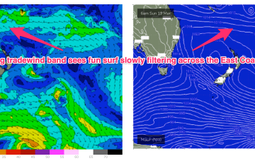
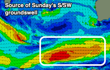
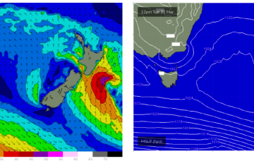
A few fun options into next week
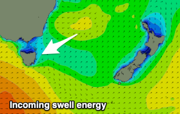
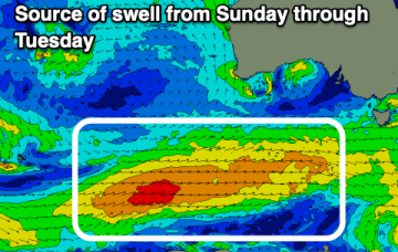
A high quickly slips E of Tas later Mon with NE winds developing and a potential NE windswell through Tues and Wed as winds feed into an inland trough.
All eyes out to the Pacific swell window this week with a typical late Summer/early Autumn pattern setting up. Low pressure centres well to the East of Fiji (near American Samoa), west of Fiji and NW of New Caledonia will all chug away on a long tradewind belt setting up presently and enhanced by a dominant high pressure cell moving SE of Tasmania early next week.
Low pressure centres well to the East of Fiji (near American Samoa), west of Fiji and NW of New Caledonia will all chug away on a long tradewind belt setting up presently and enhanced by a dominant high pressure cell moving SE of Tasmania early next week. Better positioned for the sub-tropics but E/NE swell will filter down the East Coast next week.
A shallow front will approach Victoria tomorrow, swinging the wind to the north-east early, then briefly strengthening from the north during the middle of the day ahead of a late W'ly change.
Our eastern swell window remains the focus for the coming week.
A pair of tropical disturbances straddling the Fijian region are part of an evolving atmospheric dynamic that will concurrently occupy the Coral Sea, Northern Tasman and South Pacific basins over the coming days.
A fun swell is on the way with it performing well across southern NSW.
There's plenty of westerly swell due this period with tricky but workable winds.
The surf will fade with dicey winds to end off the week. A good new swell with offshore winds is due to build through the weekend.
A building swell with light winds should provide good surf today, best down South from tomorrow until a change Saturday afternoon.