End of flat spell in sight with some fun waves from mid next week
Friday, 18 August 2023
End of flat spell in sight with some fun waves from mid next week
Friday, 18 August 2023
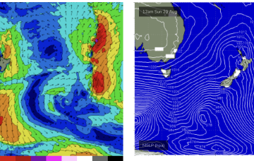
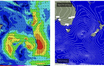
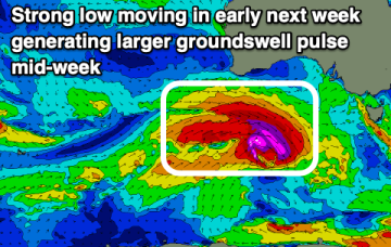
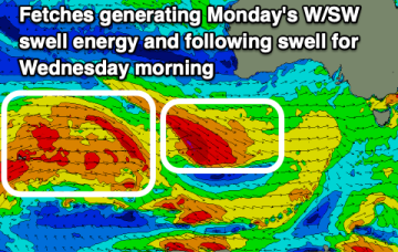
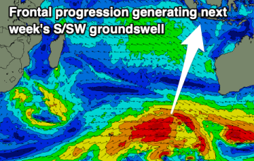
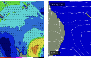
We should see an end to the flat spell by Tues next week, with a high pressure ridge building up the QLD coast and Tradewinds forming a broad fetch through the Southern/Central Coral Sea.