Increasing swell activity with varying winds
Wednesday, 30 August 2023
Increasing swell activity with varying winds
Wednesday, 30 August 2023
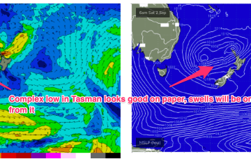
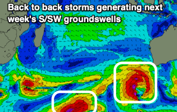
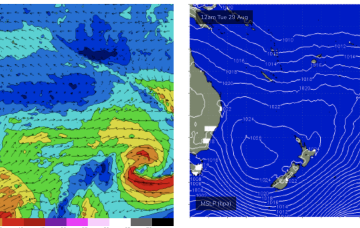
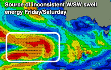
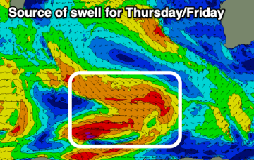
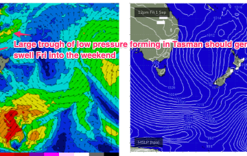
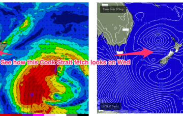
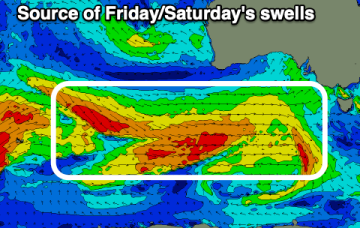
We've got lots of swell on the way, large out of the W/SW early next week with winds out of the western quadrant.