Flukier period into spring
Monday, 28 August 2023
Flukier period into spring
Monday, 28 August 2023
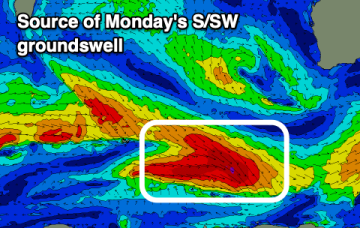
We've got less reliable swells and winds over the coming week, ahead of a strong new W/SW groundswell early next week.
We've got less reliable swells and winds over the coming week, ahead of a strong new W/SW groundswell early next week.
As winter nears an end, the run of excellent surf and conditions begins to fall apart.
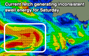
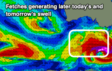
We've got plenty of swell to work with this weekend with varying but mostly light winds apart from Sunday afternoon.
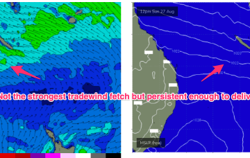
We’ve got tradewinds now established in the Central Coral Sea and the development of small, fun surf across CQ.
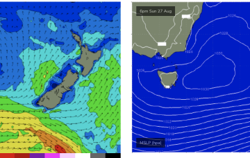
We may see some more local E/NE swell to 2ft fill in as winds feed into a trough off the Gippsland coast which drifts down towards Flinders Island.
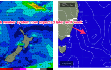
We’ve still got the basic building blocks in place that we mentioned on Wed with the proviso that everything looks a little weaker and disjointed. High pressure moves NE of Tasmania and the troughs remain inland, although we may see a weaker trough area move off the North Coast of NSW early in the week. SE-E/SE tradewinds are established in the Central Coral Sea and will supply small tradewind swell for the first half of the week at least.
We’ve still got the basic building blocks in place that we mentioned on Wed with the proviso that everything looks a little weaker and disjointed. High pressure moves NE of Tasmania and the troughs remain inland, although we may see a weaker trough area move off the North Coast of NSW early in the week.
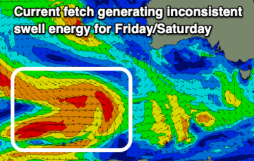
We've got more favourable winds but weaker, smaller swells on the cards.
The run of clean, solid swell will come to an end from this afternoon for the South Coast so make the most of it.
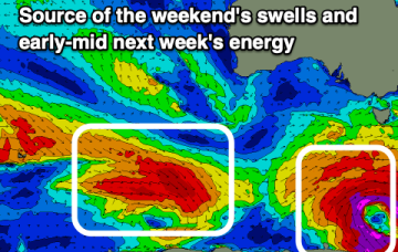
We've got a strong pulse of W/SW-SW swell for later today and tomorrow but with average winds, deteriorating further Sunday. Next week looks smaller and fluky.