A few small options to close out the week with an extended spell of N'lies from this weekend into next week
Wednesday, 27 September 2023
A few small options to close out the week with an extended spell of N'lies from this weekend into next week
Wednesday, 27 September 2023
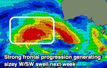
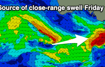
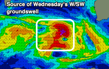
High cells are now tending to move NE as they enter the Tasman, bringing N’ly episodes which were rare through our triple La Niña but are becoming common as we enter El Niño proper. Small, combination swells and some light wind periods pad out the rest of the week with a more entrenched N’ly episode next week.