Slow, windy week ahead
Monday, 18 September 2023

Slow, windy week ahead
Monday, 18 September 2023
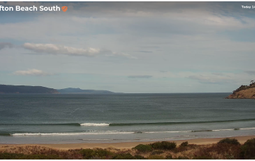
In short, it's looking to be a small, windy week across the South Arm.
In short, it's looking to be a small, windy week across the South Arm.
Once the SE surge becomes established Fri into the weekend we’ll see another round of fun sized E/SE swell developing, likely into the 2ft range Sun/Mon and holding at that size before easing Tues/Wed as the SE wind field contracts to the North, away from the CQ swell window.
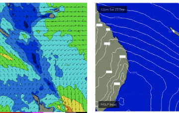
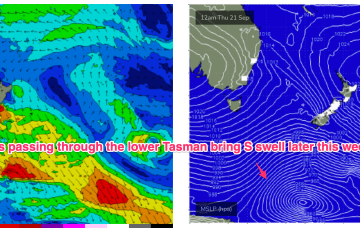
We’ve got another slow moving pattern on our hands to start the week with a high pressure belt at sub-tropical latitudes directing a W’ly to NW’ly flow across the state and a very zonal (W-E) storm track tracking through the far southern Tasman Sea.
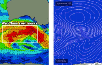
We’ve got another active week of surf ahead, with the Southern Ocean still quite busy with a powerful frontal conveyor belt pushing under the continent.
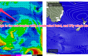
A tradewind band has slowly weakened and contracted eastwards but is expected to remain slow moving this week, maintaining a fun signal of E-E/NE swell.
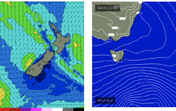
We’ve got another slow moving pattern on our hands to start the week with a high pressure belt at sub-tropical latitudes directing a N’ly flow across the state and a very zonal (W-E) storm track tracking through the far southern Tasman Sea. A tradewind band has weakened and contracted eastwards but is expected to remain slow moving this week, maintaining a small, background signal of E/NE swell.
We've got a whole week of windy westerlies on the cards as a strong conveyor belt of fronts cross the state.
As for surf, the overarching trend is for several overlapping pulses to provide plenty of waves across both coasts, though it'll be a slow start down south owing to the dominant westerly direction.
We've had another further uptick in size potential for the weekend, though I am trying to keep my expectations in check due to the dominant westerly swell direction.
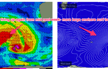
Mid week, the blocking pattern breaks down and we see another series of powerful disturbances track NE of Heard Island with multiple swell generating fetches becoming active again in the SE Indian Ocean from mid-late next week. With another series of gale to severe gale force fetches active we’ll see another period of over-lapping swell trains and elevated wave heights across the SW corner, likely with onshore winds again reflecting the northwards located high.