Fun waves developing on the beaches from Sunday

Victoria Forecast by Craig Brokensha (issued Friday 16th November)
Best Days: Beaches Sunday morning, beaches Monday, beaches Tuesday
Recap
An average increase in swell yesterday morning with onshore winds across all locations, better into the afternoon with our stronger SW groundswell filling in and with a slight drop in wind strength.
This morning our variable breeze has come in across selected locations on the Victorian coast along with good sized though full and easing SW groundswell.
We should see winds become variable across most locations through the morning with improving conditions as the tide drops before a fresher S/SW breeze kicks in early afternoon.
Today’s Forecaster Notes are brought to you by Rip Curl
This weekend and next week (Nov 17 – 23)
We'll see our current groundswell continuing to ease off into the weekend, but some inconsistent and reinforcing mid-period SW swell should halt the easing trend, ahead of a better increase in long and medium-range swell Sunday afternoon, easing Monday.
Conditions will remain average tomorrow with a moderate to fresh S/SE breeze across all locations and 2ft+ waves on the Surf Coast, 3-4ft to the east.
 Sunday morning looks to start around a similar size, though the new inconsistent groundswell and mid-period swells (generated by a distant fetch of W/SW gales east of Heard Island and fetches currently under WA) should provide better 2-3ft sets on Surf Coast through the day and 3-5ft waves on the Mornington Peninsula.
Conditions will improve across the open beaches, with a NE offshore developing through the morning (not great early). Into the afternoon as the new swell peaks, fresh SE sea breezes will create average conditions.
Monday is looking much better with a N/NE offshore due to persist most of the day on the Mornington Peninsula, if not tending N'th mid-late afternoon, with a shift to N/NW breezes on the Surf Coast.
Size wise we'll see Sunday afternoon's groundswell easing from 2ft to possibly 3ft on the Surf Coast swell magnets, and the 4ft range on the Mornington Peninsula.
Another less consistent and longer-range SW groundswell is due to fill in later Monday and peak Tuesday, produced by a stronger but more distant polar low in the Heard Island region the last couple of days.
Very inconsistent 2ft waves are expected on the Surf Coast, with 3ft+ sets to the east, and winds look favourable for those exposed beaches again with a morning N/NE breeze ahead of a late SW change.
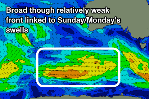
The change will be linked to a broad but weak front moving in from the west and with this we're likely to see a mid-period SW swell building later in the week though with no major size or quality.
We'll have a closer look at this Monday. Have a great weekend!