Fun waves at most beaches Saturday morning

Victoria Forecast by Craig Brokensha (issued Friday 22nd September)
Best Days: Both coasts Saturday morning, Surf Coast Monday keen surfers
Recap
Wednesday's pumping SW groundswell dropped right back into yesterday leaving fading 2ft sets across the Surf Coast and 3ft+ waves on the Mornington Peninsula with gusty N'ly winds.
Today a new W/SW swell was running a little late at dawn, but it's since started to build across the state with 13th Beach now seeing inconsistent 3ft sets. Conditions were great with a light N'ly wind and the Mornington Peninsula is also shaping up super nicely.
We should see this swell hold around 3ft on the sets into the afternoon on the Surf Coast and reach 4-6ft on the Mornington Peninsula with sea breezes kicking in mid-afternoon.
This weekend and next week (Sep 23 – 29)
Today's increase in W/SW swell will hang around into tomorrow morning, due to the slow moving and long-lived nature of the mid-latitude low that generated it.
We should see the Surf Coast easing back from 2-3ft during the morning with sets in the 4-5ft range on the Mornington Peninsula.
Winds will be good for all locations again through the morning and locally offshore, tending W/NW into the afternoon.
A low point in swell is still expected Sunday morning and strengthening NW tending W/NW winds will create average conditions with no size due across the Surf Coast.
A tricky mid-latitude low moving in from the west may generate a late increase in W/SW swell but Monday is a better chance for this. Our models are showing a kick in size Sunday afternoon for the Surf Coast, but the chances of this are very slim and it's not worth the drive from Melbourne.
 Into Monday morning, the fetch of strong to gale-force W/SW winds aimed towards us Sunday afternoon and evening should produce a small weak W/SW swell to 2ft to maybe 3ft on the Surf Coast and 3-5ft on the Mornington Peninsula.
W/NW winds will create clean conditions across the Surf Coast all day though don't expect any amazing surf. The swell will fade through Tuesday and a morning W/NW breeze will again favour the Surf Coast, but there'll be no major size leftover.
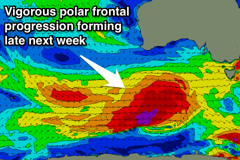
The swell will remain minimal into Wednesday as winds swing around to the E/NE but this will only be a temporary window before we head back into a strong winteresque polar frontal progression late week.
A strong node of the LWT is forecast to develop over the Bight late next week, pushing across us into the weekend, bringing with it series of strong and broad polar storms.
It's too early to nail down the particulars of this setup yet so check back Monday for an update on how late next week/weekend is shaping up. Have a great weekend!