Fun at swell magnets over the weekend, good infrequent swell Monday

Victoria Forecast by Craig Brokensha (issued Friday 17th March)
Best Days: East of Melbourne Saturday and Sunday, Monday morning
Recap
Small clean waves across both coasts early yesterday with smaller 2ft sets on the Surf Coast and 3-4ft waves on the Mornington Peninsula. Winds shifted onshore across most spots, but held from the W at selected spots on the Surf Coast as the swell continued to ease back to 1-2ft.
Overnight a gusty onshore change moved through and this is creating terrible conditions this morning along with a mix of W/SW groundswell and windswell.
This weekend and next week (Mar 18 – 24)
The weekend will be great across exposed breaks on the Victorian coast with a small reinforcing W/SW swell keeping 2ft waves hitting the Surf Coast and 3-4ft sets on the Mornington Peninsula tomorrow morning. The surf will ease through the day and Sunday will be smaller and very inconsistent with a very long-range W/SW groundswell (2-3ft into the afternoon).
 A light NE wind will create good conditions east of Melbourne tomorrow, with light local offshore winds Sunday morning.
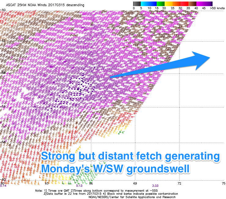
Sunday's very long-range and inconsistent W/SW groundswell will be the first of two, with the second larger and slightly more consistent swell filling in Monday.
This has been generated by a re-intensification of the polar low in the Heard Island region, projecting a fetch of severe-gale to near storm-force W/SW winds north-east towards WA (through our western swell window).
The swell is due to fill in Monday under more favourable winds now from the N/NE during the morning.
The Surf Coast should build to an inconsistent 3-4ft at swell magnets on the Surf Coast during the day, with 5-6ft+ sets on the Mornington Peninsula.
 Tuesday's winds are still a little tricky as a small surface trough approaches from the west, likely bringing an onshore change as the W/SW swell eases.
For the rest of the week we're looking at onshore winds as the surface trough moves off the East Coast and deepens, directing SE winds across the state until Friday.
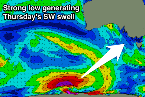
This will spoil a good new S/SW groundswell due Thursday morning, produced by an intense polar low Sunday and Monday. The size off this low is expected to be around 3-4ft on the Surf Coast and 6ft on the Mornington Peninsula, but we'll look at this again Monday.
Beyond this there's nothing major jumping out on the charts, but check back Monday for the latest update. Have a great weekend!