Fun period ahead of westerly swells, larger next Thursday

Victoria Forecast by Craig Brokensha (issued Friday 15th July)
Best Days: Surf Coast the whole period, east of Melbourne tomorrow afternoon and Sunday
Recap
Large clean pumping waves playing out as forecast on the Surf Coast yesterday with 6ft+ sets and all day offshores as the swell slowly eased. Today the surf is still great with a reinforcing groundswell, more around 5-6ft on the Surf Coast with bumpy larger waves to the east.
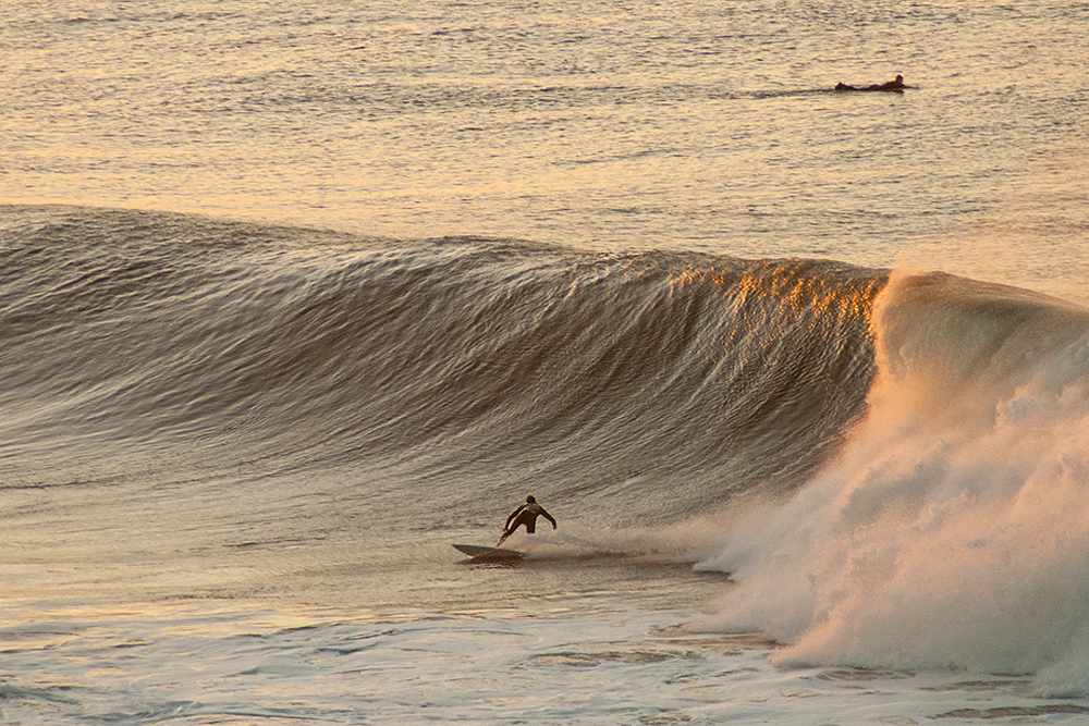
Photo Judy Scanlon
This weekend (Jul 16 - 17)
Good conditions are due all weekend on the Surf Coast with a NW tending variable wind tomorrow and N/NW winds Sunday. The Mornington Peninsula will be best Sunday with a N'ly persisting most of the day.
Our current swell will continue to ease back and come in around 3ft+ across swell magnets on the Surf Coast and 5-6ft on the Mornington Peninsula through the morning, smaller through the day.
Later in the day a new W/SW groundswell is due, but Sunday will provide the most size as the swell peaks.
This swell was generated by a strong storm that's developed off WA, with fetches of pre-frontal W/NW-NW gales.
Similar but inconsistent 3ft+ waves are due at swell magnets on the Surf Coast with 6ft sets on the Mornington Peninsula Sunday with this favourable winds.
Next week onwards (Jul 18 onwards)
Sunday's W/SW groundswell is expected to start easing through Monday under N/NW tending NW winds favouring the Surf Coast again.
Tuesday should hold an inconsistent 2-3ft on the Surf Coast and 4-6ft on the Mornington Peninsula as another long-range pulse of W/SW groundswell fills in, generated on the backside of the frontal progression firing up towards WA.
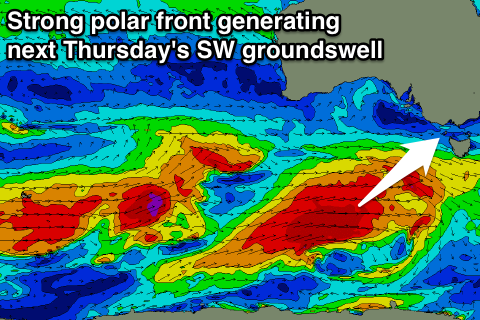 Into the end of the middle to end of the week a good pulse of moderate to large sized SW groundswell is on the cards.
A strong polar low firing up east of Heard Island will push east-northeast towards us from Sunday through early next week, generating a fetch of gale to severe-gale W/SW winds.
The swell from this system will be a great long-period SW number and should peak Thursday to 4-5ft on the Surf Coast and 6-8ft on the Mornington Peninsula. Winds look favourable and offshore from the N/NW at this stage, but more on this Monday. Have a great weekend!
Comments
Looking pretty good at 13th Beach this arvo.