Thursday the pick of the week

Victoria Forecast by Craig Brokensha (issued Monday 30th May)
Best Days: East of Melbourne Tuesday, Wednesday, both coasts Thursday, east of Melbourne again Friday and then Sunday morning both coasts
Recap
Average onshore waves Saturday with workable waves on the Surf Coast yesterday morning with an easing swell.
Today conditions were cleaner across all locations but with a small 1-2ft wave on the Surf Coast and better 3ft+ sets on the Mornington Peninsula.
This week (May 31 – Jun 3)
As Ben mentioned a couple of weeks ago when he took over, it's a little tricky coming in cold to a forecast, but we'll stick with Ben's numbers for tomorrow with the arrival of a new inconsistent W/SW groundswell due this evening.
The westerly swell direction and N/NE tending E/NE offshores will favour exposed locations east of Melbourne, with infrequent 3-4ft sets due. The Surf Coast will remain small with 1-2ft surf at swell magnets.
Come Wednesday the swell will be easing with tiny waves left west of Melbourne and easing 3ft sets to the east along with favourable N/NE winds again, tending more variable into the afternoon.
Into Thursday a very strong long-period but distant and inconsistent W/SW groundswell is due to fill in, generated over the weekend and into today by a broad and vigorous polar frontal progression firing up in the southern Indian Ocean.
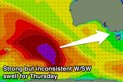 The size and scope of this swell is impressive with large waves due for Indonesia, West Oz and South Oz, but the large travel distance to our coasts will result in a lot of swell decay. The westerly direction isn't ideal either for the Surf Coast.
The long-period forerunners are due to arrive through Wednesday with a late kick in size due to be seen mainly across the Mornington Peninsula, with a peak Thursday.
I've only see the final stages of this progression yesterday and this morning, and have upgraded Ben's expected sized just a touch.
We should see infrequent 3ft to occasionally 4ft sets across west swell magnets on the Surf Coast most of the day with 6ft to occasionally 8ft bombs on the Mornington Peninsula with good N'ly offshores before mid-late afternoon E/SE sea breezes.
The swell should start to ease Friday from around 3ft on the Surf Coast and 5-6ft+ on the Mornington Peninsula but with less favourable E/NE tending SE winds.
This weekend onwards (Jun 4 onwards)
Easing surf and strengthening E'ly winds are on the cards for Saturday as a dynamic and intense weather pattern develops off the East Coast, making itself felt across our region through Saturday.
We may see the system move east through Sunday swinging winds back offshore from the N/NW and a mix of background W/SW groundswell energy should provide 2ft sets on the Surf Coast and better 3-5ft waves on the Mornington Peninsula. We'll have a closer look at this Wednesday though.