Good Sunday morning, dicey but OK early Monday

Victoria Forecast by Craig Brokensha (issued Friday 28th November)
Best Days: Sunday morning, early Monday east of Melbourne
Recap
Onshore winds spoilt conditions with moderate amounts of SW swell yesterday, while today was smaller and still average with persistent winds from the S'th.
 This weekend (Nov 27- 30)
A slight kick in SW groundswell due this afternoon will ease back through tomorrow and conditions will improve slightly east of Melbourne but still remain less than ideal from the E/SE and light to moderate in strength. The Mornington Peninsula should see easing 3-4ft sets, best in protected locations.
Our solid pulse of SW groundswell Sunday is still on track, as are the winds forecast on Wednesday.
The vigorous polar low and fetch generating this swell has been picked up well by satellite observations, and we should see it fill in strongly overnight Saturday, peaking Sunday morning to 3ft on the Surf Coast and 5-6ft on the Mornington Peninsula.
Winds will be best for locations east of Melbourne and for the beaches on the Surf Coast with a moderate N/NE breeze before a fresh to strong E/SE'ly kicks in through the afternoon. There is actually a scenario where winds may tend variable and then to the SW, with a real tricky trough sitting just to our west still not being resolved well by all the weather forecast models. This will flow on into Monday's uncertainty in winds as outlined below.
Next week onwards (Dec 1 onwards)
Sunday morning's solid pulse of SW groundswell will ease off through the afternoon and further Monday, back from 1-2ft on the Surf Coast and 3-4ft on the Mornington Peninsula.
Winds are the main issue here and unfortunately they are still a little tricky to pick with the trough sitting to our west holding all the power.
If this trough slips through later Sunday we'll see N/NW tending fresh SW winds Monday, favouring the Surf Coast and western end of the Mornington Peninsula early in the day.
If it doesn't push through Sunday we'll likely see N/NE winds across the Mornington Peninsula ahead of a late SW change.
Either way there should be a window of cleaner conditions across the Mornington Peninsula early Monday to get amongst.
Into Tuesday winds are expected to revert back to the W/NW through the morning across the region, but there'll be little to no decent swell with a weak 1-2ft wave across exposed breaks on the Surf Coast.
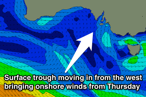
The outlook for the rest of the week is dire, with a small and inconsistent long-range W/SW groundswell due Wednesday expected to be spoilt by onshore S'ly winds as another surface trough pushes across us. Behind this E'ly winds through Thursday will favour the Mornington Peninsula but don't expect much above 3ft, and then N'ly winds into Friday but with no real size.
Therefore with the current outlook it'll be wise to make the most of Sunday morning and early Monday. Have a great weekend!