Windows each morning on the Surf Coast, east of Melbourne Monday

Victoria Forecast by Craig Brokensha (issued Wednesday 17th September)
Best Days: Possibly early tomorrow around Torquay for desperate surfers, Friday morning through Sunday morning around Torquay, Monday both coasts, Tuesday morning both coasts
Recap
The surf was poor across all coasts yesterday with an average swell and fresh to strong onshore winds.
This morning was much better across the Surf Coast with winds swinging offshore cleaning up a small but fun 2ft of swell. The Mornington Peninsula is bigger and in the 4-5ft range but chopped up with the strong W/NW breeze.
A strong W/SW change is now moving through and we'll see this kick up a low quality windswell for the afternoon, mixed in with a late increase in long-range W/SW groundswell.
This week and weekend (Sep 18 - 21)
A mix of long-range and very inconsistent W/SW groundswell along with more noticebable shorter-range SW swell is due in the wake of today's change tomorrow, coming in at 3ft+ on the Surf Coast and the 6ft range on the Mornington Peninsula but winds will be generally fresh to strong from the SW.
The Torquay region is now likely to see an early W'ly but this will only be short-lived and conditions will still be quite raw.
Wave heights should drop away from 2-3ft across the Surf Coast Friday and 4-6ft on the Mornington Peninsula with more favourable W/NW winds due early around Torquay with lingering SW winds everywhere else.
The weekend will start slow with a dropping 2ft of swell across the Surf Coast under early light W/NW winds, while the Mornington Peninsula should be in the 3-5ft range but winds will still be lingering onshore but without too much strength.
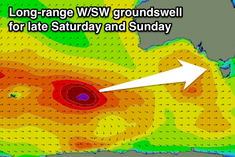 A new long-range W/SW groundswell is due later Saturday, peaking Sunday, generated by an unfavourable tracking but strong polar front south-west of WA today and tomorrow.
This should provide inconsistent 3ft sets Sunday morning across the Surf Coast with 6ft sets on the Mornington Peninsula for most of the day before easing back through Monday.
Winds are now looking a little dicey for locations east of Melbourne with a weak westerly pressure gradient. This will see W/NW tending SW winds across most breaks, favouring the Surf Coast over other locations. There is still a chance for more variable winds on the Mornington Peninsula, but we'll review this a final time Friday.
Next week onwards (Sep 22 onwards)
Monday will be the day to surf east of Melbourne as the weekend's swell tails away under offshore N'ly tending variable winds. The beaches should offer 3-5ft sets with smaller 2ft+ waves on the Surf Coast.
There's still nothing major on the cards for early next week, with yet another very long-range and inconsistent W/SW groundswell due Tuesday but not above 2ft on the Surf Coast and 3-5ft on the Mornington Peninsula. Winds will continue from the N/NW into Tuesday and Wednesday favouring the Surf Coast and western end of the Mornington Peninsula.
Later in the week there's the possibility of some better SW groundswell but we'll have another look at this Friday.