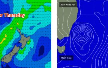
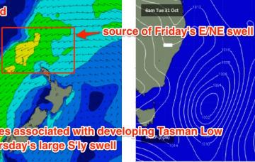
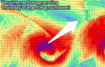
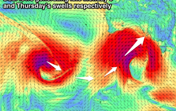
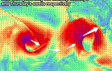
Large easing swell Tuesday, becoming large again Thursday
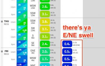
If anything, the local wind forecast for tomorrow looks a smidge better.
We’ve got a very complex week ahead, with around six individual swell sources - one out of the north, two out of the east and three out of the south.
There’s no real change to the notes issued Friday, except a little more fine tuning on size and timing for each incoming swell this week.
Prior to the development of the Tasman Low on Tuesday, we’ll see a new mid-range E’ly swell develop in our eastern swell window.
Mix of N/NE windswell and building E/NE swell tomorrow with improving winds, with the E/NE swell left into Sunday (cleanest early). Easing surf with offshores Monday then potential mid-next week.
The rest of the week looks very complex with a couple of swell sources on the cards.
Tiny all weekend and most of Monday, with a new W/SW tending SW swell for Tuesday, easing Wednesday. Stronger and better aligned W/SW swell for Thursday, easing Friday but with less than ideal winds.
New SW groundswell for tomorrow morning, with a larger and stronger swell for Sunday but with onshore winds. Clean large easing waves Monday, smaller Tuesday. Large new SW groundswell for Wednesday with favourable winds.
Building W/SW swell tomorrow afternoon on the Mid with workable onshore winds. Peak in swell Sunday morning down South with offshore winds. Large stormy swell for Monday, easing Tuesday as onshore winds persist, clean Wednesday morning with a good new SW groundswell Thursday.
No surf tomorrow, while Sunday should be fun across most breaks with a new W/SW swell and good winds. Large long-period W/SW groundswell building Monday afternoon, peaking overnight and easing Tuesday. Reinforcing swell for Thursday.