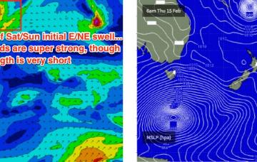
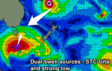
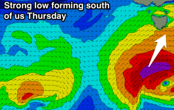
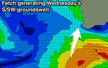
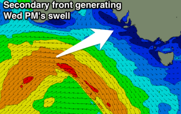
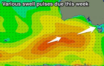
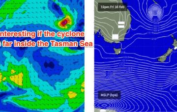
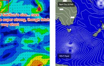
Large cyclone swell building Thursday onwards
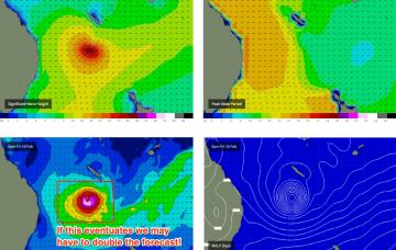
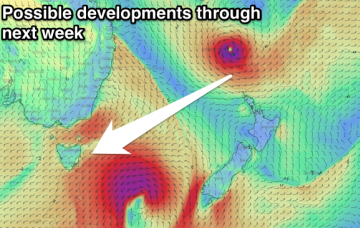
STC Gita is a very large, dangerous system that will likely reach Cat 5 this evening and persist at this strength for the next few days.
So, enough waffle.. how big is it gonna get?
Besides a small N'ly windswell pulse during the morning Wednesday, tiny ahead of slowly building levels of NE groundswell from Friday, more so through the weekend from STC Gita.
Tiny W/SW swell over the coming days with some better W/SW swell for Thursday and Friday and S/SW swell later Friday and Saturday morning. Workable and decent windows of winds.
Large easing S/SW swell tomorrow with average winds, much better Wednesday with a reinforcing S/SW swell, easing Thursday. New swell for the weekend with favourable winds as it peaks Sunday morning.
Plenty of swell this week with favourable winds for both regions at times, though the windows will be small on some days.
Fun waves across both regions tomorrow with a variable wind and building swell, best on the Surf Coast from Wednesday with winds from the western quadrant and good swell pulses.
It now looks like we’ll see at least one severe Tropical Cyclone develop east of Fiji over the coming days, tracking eastwards before recurving to the south, then east before tracking straight through the South-western Pacific enroute to the Tasman Sea.
Easing inconsistent S/SE groundswell tomorrow, with some small E/NE swell for Sunday and Monday. Possible better developments later next week.
Time to start doing some cardio, y’reckon?