Good period for the Surf Coast

Victoria Forecast by Craig Brokensha (issued Monday 12th February)
Best Days: Both coasts Tuesday morning, Surf Coast Wednesday through Sunday
Recap
Fun waves across both regions Saturday morning with a new SW swell and favourable winds ahead of an afternoon change.
Sunday was bigger but a mess with gusty onshore winds.
This morning a mix of swells were on the ease with lighter morning W'ly winds favouring protected spots on the Surf Coast with 2-3ft surf.
Today’s Forecaster Notes are brought to you by Rip Curl
This week and weekend (Feb 13 – 18)
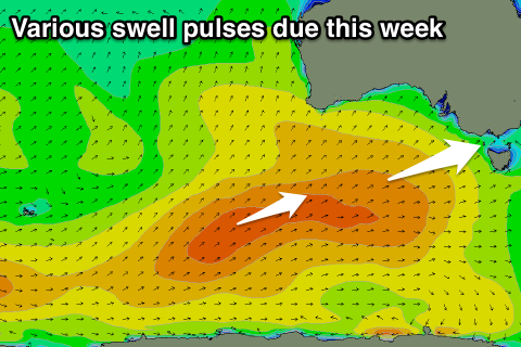
As touched on last week, we've got plenty of swell on the cards for this week, owing to a strengthening node of the Long Wave Trough moving slowly in from the Bight, bringing with it a flurry of frontal activity.
Tomorrow morning will be the smallest of the coming period, with some new W/SW swell due to build through the day, produced over the weekend by a weakening front pushing in from under WA.
This front started as a strong polar low in the Heard Island region, with that inconsistent long-period energy due to fill in Wednesday.
 But coming back to tomorrow and we should see 2ft+ waves at swell magnets on the Surf Coast early, building to 3ft+ into the afternoon, with 3-4ft surf on the Mornington Peninsula, increasing to 4-6ft into the afternoon.
Winds look favourable with variable breezes in the morning ahead of SE sea breezes.
This swell will ease into Wednesday morning as the less consistent long-period energy fills in, keeping 3ft sets hitting the Surf Coast and 4-5ft+ waves on the Mornington Peninsula.
The Surf Coast will be best but only during the morning with a strengthening N/NW tending W/NW wind ahead of a strong W/SW change around midday.
This change will be linked to a secondary front currently forming south-west of WA and racing in from the west through the Bight and across us Wednesday.
A moderate sized increase in W/SW windswell is due into Wednesday afternoon/evening from the change, likely to 3-4ft on the Surf Coast and 6ft on the Mornington Peninsula.
The swell should hold this size into Thursday morning, while a third burst of W/SW gales racing in Wednesday evening will keep the surf up into the afternoon, easing Friday.
This won't be the end though, with a stalling low due to develop south-southwest of Tassie on Thursday, aiming a fetch of severe-gale to storm-force SW winds in our southern swell window.
A good S/SW groundswell should keep 3ft+ waves hitting the Surf Coast Saturday morning and 4-6ft waves on the Mornington Peninsula.
Coming back to the wind, and the Surf Coast will be best with a gusty W/NW breeze Thursday morning, swinging W/SW mid-afternoon, with W/NW winds Friday morning, tending SW late morning.
Saturday looks great again with a NW offshore ahead of S/SW sea breezes early afternoon, similar Sunday but smaller.
Longer term there's some interesting developments on the cards with a possible ex-tropical cyclone interacting with a surface trough off the southern NSW coast, bringing stormy amounts of E/SE windswell, but more on this Wednesday.
Comments
Swell is kicking nicely..