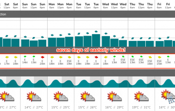
Extended period of small surf; better into the longer term
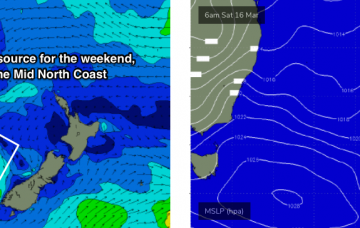
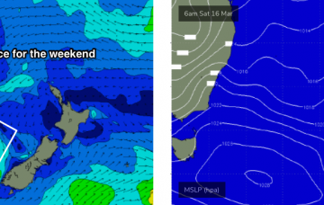
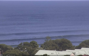
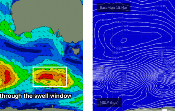
The weekend’s not looking at delivering anything amazing in the surf department.
As a side note, if you are in the water and you hear thunder, don’t hang around - lightning can travel tens of kilometres from the source region and the water is a pretty dangerous place to be at these times.
A coastal trough will linger about the region on Saturday, just north of Sydney, before moving south into Sunday, possibly forming a small low off the South Coast.
We’re on the cusp of an extended period of E’ly winds, thanks to a blocking pattern setting up camp across our immediate swell window.
Saturday morning will be very small, as we’ll be between swells, but late in the day we’ll see a building trend of new long period groundswell. More in the Forecaster Notes.
In Tuesday’s notes, I mentioned an intensifying polar low well below WA for Friday that had the possibility of generating a small unusual sideband SW swell for Sunday afternoon.
A seemingly endless supply of reasonably strong Southern Ocean lows will move track parallel to the ice shelf all week, supplying pulsey groundswell for our region throughout the medium to longer term period.
We’ve got a light pressure pattern across the coast for the rest of the week, so the mornings are looking clean-ish with light variable winds ahead of afternoon sea breezes.
On Friday, a tropical system is expected to begin slowly deepening south from Tonga, before driving south through our distant east swell window. More in the Forecaster Notes.
There isn’t a great deal of excitement expected for the next few days. However, a tropical system is expected to begin slowly deepening south from Tonga on Friday, and will generate a long lived E/NE swell event next week.