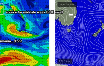
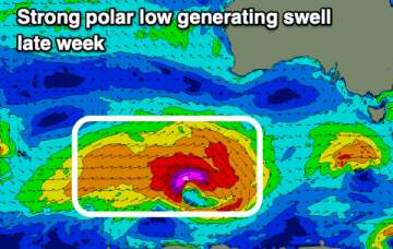
Improving surf and swells later week
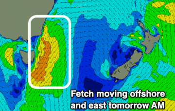
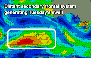
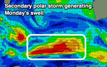
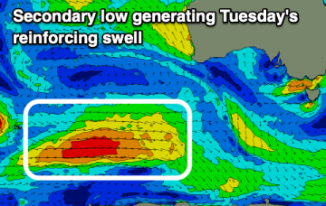
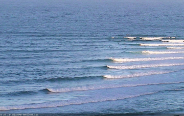
An average couple of days, besides some tiny surf on the Mid, ahead of cleaner conditions and better swells late week.
Nothing too special over the coming days, but winds will improve along with some quality swell to follow.
The NE swell energy building today will peak tomorrow morning ahead of a late afternoon change. The rest of the period is a bit so/so and still up in the air.
Nothing special this period with dicey winds, mucking with smallish westerly swells.
Plenty of swell and good winds to work around this period in the wake of today's large, powerful SW groundswell.
Nothing major for the Mid Coast, but plenty of swell for the South Coast albeit with mostly onshore winds. There's a couple of small windows for cleaner surf.
We’ve got a warning out for a developing tropical cyclone north-east of Vanuatu, which will probably occur within the next 24 hours. This is contained with an active monsoon trough, which currently stretches from Indonesia, across Northern Australia into the western Pacific and then across to the South Pacific, somewhere south of the Cook Islands and about at SE Qld latitudes. More in the Forecaster Notes.
There'll be opportunities for decent waves this period, but picking the windows will be the hardest part. One for the savvy.
The northern Tasman Sea and South Pacific remains very active under the influence of an MJO, and we’re still on track for a sustained run of sizeable E/NE swell for our region. More in the Forecaster Notes.
By and large, swell prospects for the next few days look much the same as the last few. However, conditions will change across the region, ultimately switching favouritism from the north to the south. More in the Forecaster Notes.