Good couple of days, poor thereafter
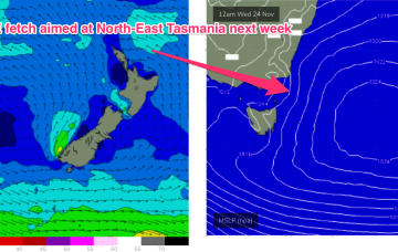
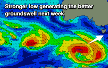
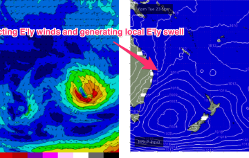
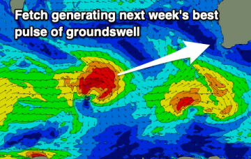
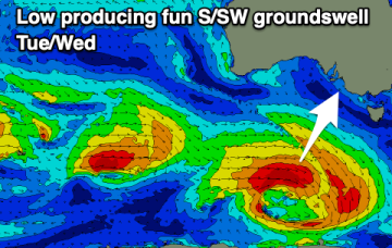
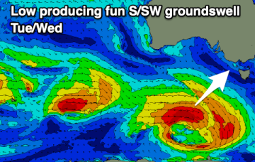
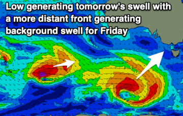
Clean conditions for the beaches with some good swell over the coming days ahead of a poor, windy end to the week.
Current model runs suggest the low is further north, and unlikely to exit the coast until late Sun evening or even early Mon. The fetch is now no longer aimed into the Tasmanian swell window so the swell due Sun/Mon, in effect, has been downgraded to almost nothing.
Lots of surfing days ahead with favourable winds and fun pulses of swell.
Dominant high pressure sits just East of Tasmania by Mon next week, directing a strong E’ly flow, likely enhanced by the remnants of the interior low sitting off the Central/Mid-North NSW Coast.
There's nowhere to recommend for the weekend but we've got some better swells into the middle of next week.
The pattern as we described it on Wed remains fundamentally the same, but the position of the moving parts has shifted so there’s some significant changes to the weekend f/cast.
The weekend still looks poor but we've got better winds due into early next week.
The wind outlook for the coming period is more favourable opening up better opportunities for a surf.
Weak fronts are below the country and an inland low is tracking across from WA, tied to the continuing pattern of interior troughiness which is associated with a developing La Nina pattern. This pattern, which has been with us for most of the last few weeks is favourably disposed towards Tasmania for swell production, albeit with some periods of unfavourable winds ahead.
Weak fronts are below the country and an inland low is tracking across from WA, tied to the continuing pattern of interior troughiness which is associated with a developing La Nina pattern. This pattern, which has been with us for most of the last few weeks, is expected to see continuing small, flukey swells into the medium term.