Swells and winds ebb and pulse
Monday, 15 August 2022
Swells and winds ebb and pulse
Monday, 15 August 2022
Multiple different swells mainly from the west with tricky, varying winds, best north of Margs.
Multiple different swells mainly from the west with tricky, varying winds, best north of Margs.
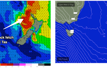
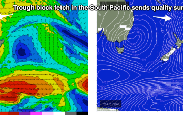
A deep low just to the East of Tasmania is now slowly weakening and moving away, maintaining a westerly flow across the region. A trough line linked to the low extends from the Tasman Sea up into the Coral Sea past New Caledonia and over the next few days this trough deepens as it slowly moves East, activating an incredibly wide fetch of E to NE winds infeeding into it.
A trough line linked to the low extends from the Tasman Sea up into the Coral Sea past New Caledonia and over the next few days this trough deepens as it slowly moves East, activating an incredibly wide fetch of E to NE winds infeeding into it. We’re still looking good for a few days of quality surf from this source late in the week and into the weekend.
A deep low just to the East of Tasmania is now slowly weakening and moving away, maintaining a westerly flow across the region. A trough line linked to the low extends from the Tasman Sea up into the Coral Sea past New Caledonia and over the next few days this trough deepens as it slowly moves East, activating an incredibly wide fetch of E to NE winds infeeding into it.
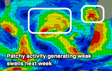
Nothing of note this week once winds go onshore this afternoon. Better surf into the weekend.
We've got some better swell sources on the cards for the coming period in regards to the Surf Coast.
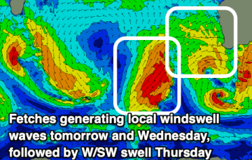
Tricky winds and swell this period as a low retro-grades then goes back to the east.
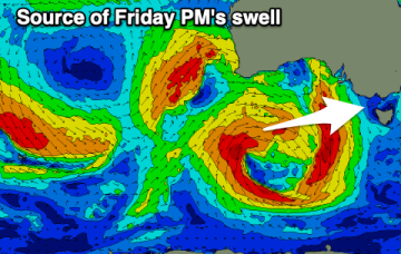
The low will approach Tasmania over the weekend with a strong E’ly infeed expected to generate large surf. Models now show much less size as the fetch is not directly aimed at Tasmania and not as powerful as Wed’s notes indicated. We’re still looking at solid surf through from Sun into next week!
Plenty of swell this weekend with tricky winds, dicier next week as surface troughs and fronts move across us.
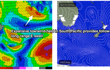
While this is happening a long trough line in the near South Pacific forms and deepens with a wind speeds increasing along a broad front due south of New Caledonia as they feed into the trough. Strong winds to gales feeding into the fetch through Tues-Thurs are expected to generate quality E/NE swell trains for the region.