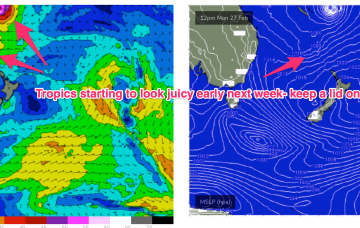
Tricky outlook due to local winds
Monday, 27 February 2023
Tricky outlook due to local winds
Monday, 27 February 2023
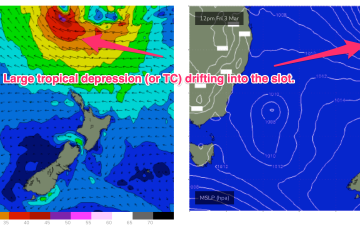
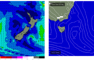
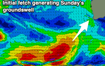
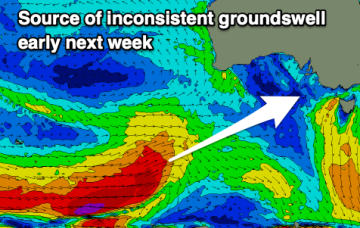
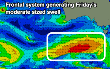
There's no clear standout day this period but there'll be flukey periods of lighter, more favourable winds along with plenty of swell.