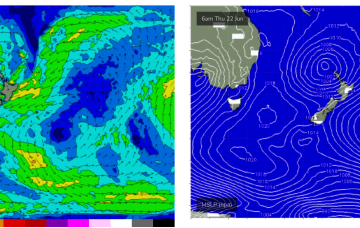
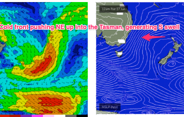
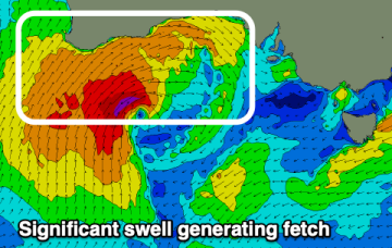
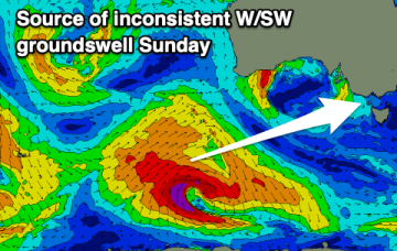
Next dose of large, windy swell incoming
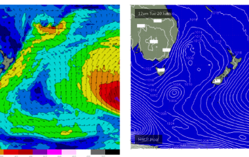
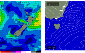
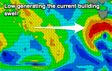
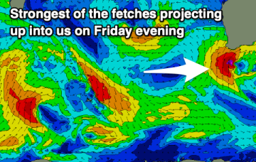
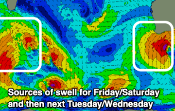
Winds will strengthen tomorrow and the swell will increase again, easing and improving through the weekend.
Into next week and it looks like a much more active period ahead now, with strong frontal intrusion into the Tasman Sea and plenty of directional S swell ahead.
Yesterdays large area of low pressure consolidated nicely in the Tasman and is now slow moving as it approaches the North Island. The head of the fetch reached sub-tropical latitudes, aiding swell spread into SEQLD. Off-axis SSW-SW winds hold through today and tomorrow in the Central Tasman leading to a slow decline in S-S/SE swell for the region through this time frame.
The end of the week isn't too crash hot, with a large, windy west swell developing through the weekend.
Looks like a much more active period ahead now, with strong frontal intrusion into the Tasman Sea and plenty of directional S swell ahead.
The coming few days will be slow ahead of some possible better swell potential next week.
None of these features generate swell for CQ, so we're looking at a typical winter flat spell.
The end of the week now looks good for a chunky NE windswell as twin high pressures develop a fetch of NE winds off the South Coast which intensify in response to approaching frontal systems. There’ll also be some E-E/NE swell from a fetch near the North Island.
The outlook is very slow after Wednesday so make the most of the current swell episode.
The wind and poor conditions kick back in this week with a couple of windows to the north.