Less reliable period of swell/winds
Wednesday, 9 August 2023
Less reliable period of swell/winds
Wednesday, 9 August 2023
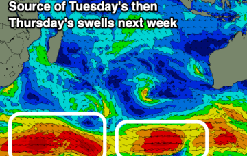
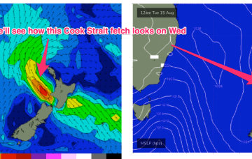
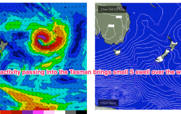
Make the most of this morning's surf, with the coming days looking slower and smaller. There's a decent swell event inbound but winds are tricky.