Fun surf days ahead
Wednesday, 19 January 2022
Fun surf days ahead
Wednesday, 19 January 2022
Nothing major swell wise but there are fun days on the cards for all regions this period.
Nothing major swell wise but there are fun days on the cards for all regions this period.
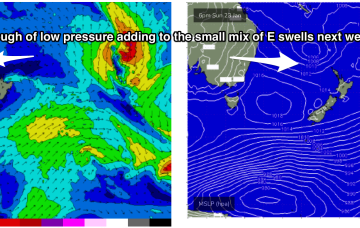
A classic Summer blocking pattern is now setting up with a slow moving high drifting well south of Victoria and a series of troughs interacting with a strong high pressure ridge which has reached Central NSW and is now building into more sub-tropical regions.
A classic Summer blocking pattern is now setting up, with a slow moving high drifting well south of Victoria and a series of troughs interacting with a strong high pressure ridge which has reached Central NSW and is now building into more sub-tropical regions.
There's not much to get excited about this period, no matter how you polish it.
It's not a healthy looking forecast with limited swell energy though with favourable winds for the exposed beaches.
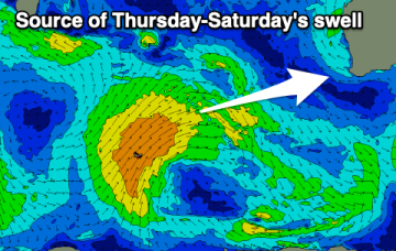
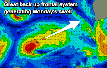
A storm coming off the southern flank of the Gyre early this week intensifies to storm force as it approaches the dateline generating a large area of 30ft seas into the middle of the week.
A new mix of swells are due from tomorrow but with initially average winds, improving on the backside.
Some fun swell with favourable conditions are due from later week.
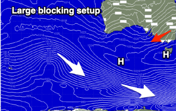
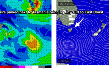
With high pressure parking itself beside Tasmania for most of this week we’re expecting a period of tiny surf to become established through Thurs into the weekend and early next week, with swell sources effectively blocked by the large high .
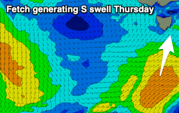
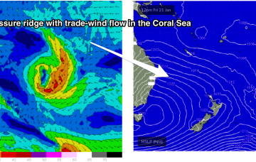
By Fri an extensive coverage of 20-25knot SE winds through the lower Coral Sea should rebuild wave heights into the 1-2ft range across the region, with surf holding into the weekend before slowly easing next week as the trade flow weakens.