Fun weekend, building windy swells next week
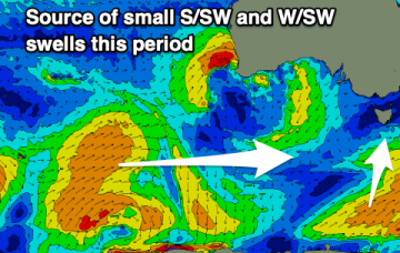
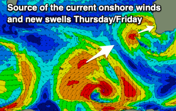
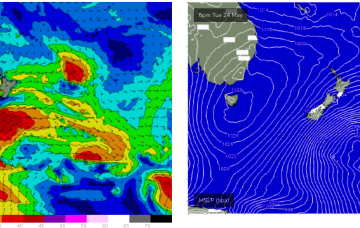
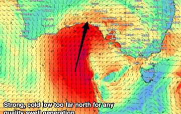
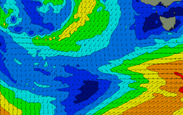
A fun weekend across spots west of Melbourne with a window to the east next week before a strong, cold low moves in across us.
Through later Wed we’ll see some small NE windswell pop up as the high meanders into the Tasman and the western flank pushes NE winds down the coast from southern NSW into Bass Strait.
Nothing standout with small to tiny waves for the keen through this period.
Sub-tropical troughs and the remnants of TC Gina near New Caledonia are maintaining a deep E’ly flow through the Coral Sea, which has seen plenty of surf across the CQ coast.
Improving conditions from Wednesday with a mix of swells sources, windy and cold from Sunday with a strong polar frontal progression.
Sub-tropical troughs and the remnants of TC Gina near New Caledonia are maintaining a deep E’ly flow through the Coral Sea while the last in a series of powerful cold fronts are now sweeping up past the South Island of New Zealand with small S to SSE swell pulses to come over the next couple of days from this source.
Nothing to recommend this week with cold, windy surf into next week.
A small week ahead of some new, fun swell on the weekend. Windy and cold next week.
A strong polar low will develop below the state later this weekend and reach peak intensity on the eastern periphery of our swell window - i.e. below the Tasman Sea - early next week.