Quick peak in swell from Coral Sea low coincides with offshore winds, then easing all week
Monday, 24 October 2022
Quick peak in swell from Coral Sea low coincides with offshore winds, then easing all week
Monday, 24 October 2022
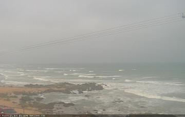
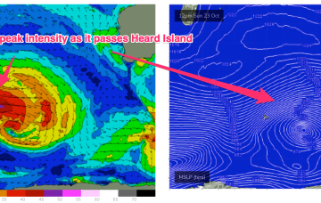
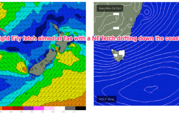
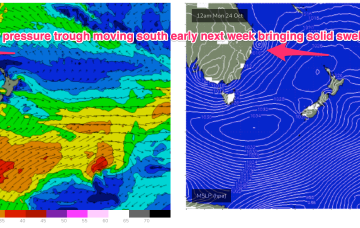
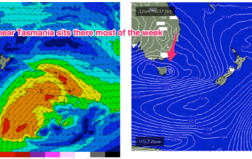
A sub-tropical low which threatened SEQLD and NENSW over the weekend after it formed off the Capricorn coast is now steaming southwards at a fair clip, sliding along a high pressure ridge from a large (1035 hPa) high under Tasmania. The low is expected to merge with an inland low and horseshoe trough on the Gippsland Coast tomorrow forming a stalled low pressure gyre near Tasmania.