Lots of size expected from the NE and E under a dynamic pattern
Wednesday, 19 October 2022
Lots of size expected from the NE and E under a dynamic pattern
Wednesday, 19 October 2022
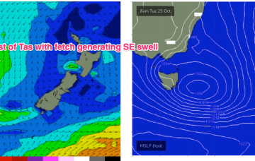
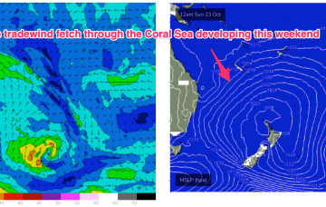
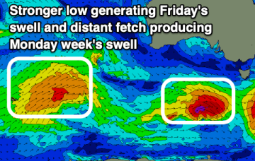
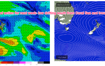
The onshore flow is enhanced into a deeper tradewind flow up in the Coral Sea, which gets a boost from a trough of low pressure expected to form off the Central QLD Coast this weekend before drifting south as a surface low, bringing sizey swell from the East and dynamic weather. The trough of low-pressure from inland Victoria is expected to drift SE of Tasmania over the weekend with plenty of swell expected.